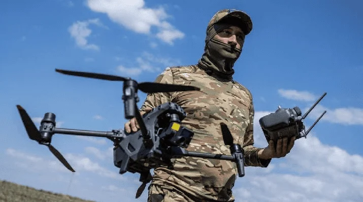
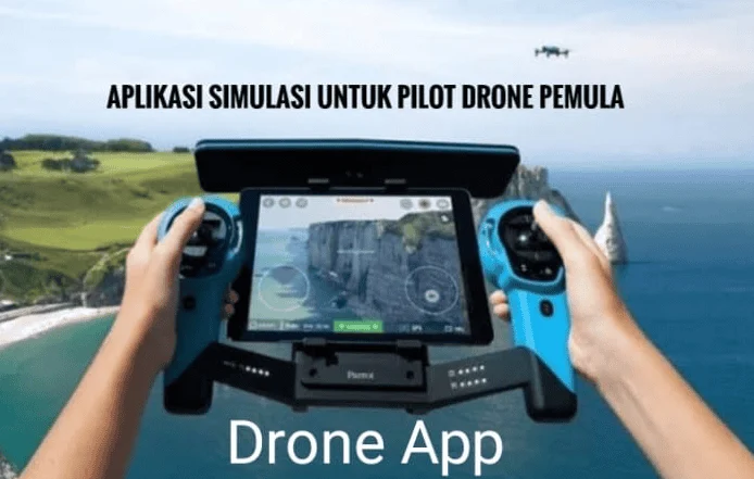
The global unmanned aerial vehicle (UAV) market has undergone a radical transformation over the last decade, transitioning from a niche hobbyist pursuit into a multi-billion-dollar industry integral to sectors such as agriculture, construction, cinematography, and emergency services. As the density of the global airspace increases, the necessity for sophisticated software tools to manage flight safety, regulatory compliance, and data acquisition has become paramount. For the modern drone pilot, the hardware—the drone itself—is only half of the equation; the other half is a comprehensive suite of digital applications that ensure every flight is conducted within legal boundaries and optimal environmental conditions. Flying a drone without proper software preparation is increasingly viewed by industry experts as a high-risk endeavor, comparable to operating a vehicle without navigational aids or safety sensors.
The Evolution of the Digital Drone Ecosystem
In the early stages of consumer drone technology, pilots relied primarily on line-of-sight visual cues and rudimentary telemetry. However, as the Federal Aviation Administration (FAA) in the United States and the European Union Aviation Safety Agency (EASA) worldwide began codifying drone regulations, the "digital cockpit" became a necessity. The introduction of the Low Altitude Authorization and Notification Capability (LAANC) in the U.S. marked a turning point, allowing for real-time, automated airspace authorizations. This shift necessitated a new generation of mobile applications capable of communicating with government databases and providing pilots with instantaneous feedback on where and when they can fly.
According to recent industry reports, the number of registered commercial drones is expected to surpass 1.5 million globally by 2026. This proliferation has led to a crowded low-altitude airspace, making situational awareness tools the most critical component of a pilot’s toolkit. The modern pilot must now balance flight dynamics with complex data points, including solar activity, wind shear, and temporary flight restrictions (TFRs) issued for VIP movements or emergency operations.
Airspace Awareness and Regulatory Compliance Applications
The primary concern for any drone operator is the legality of their flight. Entering a "No Fly Zone" (NFZ) or restricted airspace near an airport can lead to severe legal repercussions, including heavy fines and the revocation of pilot licenses. To mitigate these risks, several applications have become industry standards for mapping and authorization.
AirMap and the Integration of Real-Time Data
AirMap remains one of the most robust platforms for global airspace information. It provides high-resolution maps that delineate controlled airspace, restricted areas, and advisory zones. One of its most significant features is its integration with the LAANC system, which allows pilots to request and receive near-instantaneous authorization to fly in controlled airspace under 400 feet. This digital handshake between the pilot and air traffic control has revolutionized how commercial operations are conducted in urban environments.
B4UFLY and Government-Backed Safety
Developed as a partnership between the FAA and private industry, the B4UFLY app serves as the first line of defense for recreational and commercial pilots alike. It utilizes a simple "status indicator" (Proceed with Caution, Warning, or Do Not Fly) based on the user’s GPS location. While it lacks some of the advanced mission planning features of professional suites, its reliability in identifying national parks, military bases, and critical infrastructure makes it an essential baseline tool.
DroneDeploy for Industrial Mapping and Surveying
For pilots operating in the commercial sphere, particularly in construction and agriculture, DroneDeploy represents the pinnacle of autonomous flight and data processing. Unlike basic navigation apps, DroneDeploy allows pilots to "draw" a perimeter on a map; the software then automatically calculates the flight path, triggers the camera, and ensures sufficient overlap for 3D modeling or orthomosaic mapping. This automation reduces human error and ensures that the data collected is scientifically viable for site inspections and crop health analysis.
Meteorological Precision and Environmental Risk Management
Drones are inherently sensitive to environmental variables. A sudden gust of wind or a drop in temperature can drastically reduce battery life or cause a total loss of control. Furthermore, electromagnetic interference from solar activity can disrupt the GPS and magnetometer sensors that drones rely on for stability.
UAV Forecast: The Pilot’s Essential Weather Briefing
UAV Forecast is widely regarded as the most comprehensive weather tool for drone operations. It goes beyond basic temperature and precipitation reports to provide data on the "K-index," which measures geomagnetic storms. High K-index values can lead to GPS "drifting," where a drone fails to hold its position accurately. Additionally, the app provides "wind at altitude" data; since wind speeds are significantly higher at 200–400 feet than at ground level, this feature prevents pilots from launching into conditions that their aircraft cannot overcome.
Windy.com: Visualizing Global Atmospheric Patterns
While not exclusively a drone app, Windy.com has been adopted by the UAV community for its superior visualization of wind gusts, cloud base heights, and thermal currents. For long-range operations or high-altitude mountain filming, Windy provides a macro-view of weather systems, allowing pilots to predict windows of opportunity hours or even days in advance.
Advanced Flight Control and the Rise of Third-Party Ecosystems
While most drone manufacturers provide proprietary apps—such as the DJI Fly, DJI GO 4, and DJI Pilot series—there is a growing market for third-party flight controllers that unlock hidden capabilities of the hardware.
The DJI Ecosystem and its Dominance
DJI remains the market leader, and its software suite is designed to be user-friendly for beginners while offering "Pro" modes for experienced cinematographers. These apps manage everything from battery health and firmware updates to complex "Intelligent Flight Modes" like ActiveTrack and Waypoints. However, the "closed" nature of these apps sometimes limits customization, leading professional pilots to seek alternatives.
Litchi: Unlocking Autonomous Potential
Litchi has gained a cult following among DJI users because it enables features that the official apps often omit for certain models. Most notably, Litchi allows for "Mission Hub" planning, where a pilot can plan a complex, multi-point flight path on a desktop computer and sync it to their mobile device. The drone then executes the flight with precision, allowing the pilot to focus entirely on camera movement and framing. This is particularly useful for "hyperlapse" photography or repeat-path filming used in time-lapse construction monitoring.
Autel Explorer and the Competitive Landscape
As pilots look for alternatives to DJI due to data security concerns or hardware preferences, Autel Robotics has emerged as a significant player. The Autel Explorer app provides a professional-grade interface that emphasizes 4K and 6K video settings and thermal imaging overlays, catering to the public safety and inspection markets.
Post-Production and Site Planning: The Final Stages of the Workflow
A successful drone mission does not end when the aircraft lands. The processing of aerial data and the editing of high-bitrate video are where the value of a flight is truly realized.
The Mobile Editing Revolution: CapCut and Adobe Premiere Rush
The demand for immediate social media content has moved the editing suite from the desktop to the smartphone. Apps like CapCut and Adobe Premiere Rush are optimized for handling the 4K H.265 video files commonly produced by modern drones. These apps allow pilots to apply color LUTs (Look-Up Tables), stabilize footage, and add transitions while still in the field, facilitating a rapid "shoot-to-publish" workflow.
Sun Surveyor and PhotoPills: Mastering the Golden Hour
For aerial cinematographers, lighting is everything. Sun Surveyor and PhotoPills allow pilots to use Augmented Reality (AR) to see exactly where the sun or moon will be at a specific time of day. By predicting the angle of shadows and the timing of the "Golden Hour," pilots can plan their flights to capture the most dramatic and aesthetically pleasing footage, reducing the need for multiple trips to the same location.
Chronology of Technical Integration: From Manual to Autonomous
The evolution of these applications follows a clear timeline of technological advancement. Between 2010 and 2015, drone software was largely focused on basic connectivity and video transmission. The period from 2016 to 2020 saw the "Regulatory Boom," where apps like AirMap and B4UFLY became essential due to the implementation of Part 107 regulations in the U.S. and similar frameworks elsewhere.
From 2021 to the present, the focus has shifted toward "Intelligent Autonomy." Modern applications are now incorporating Artificial Intelligence (AI) to assist in obstacle avoidance, automated subject tracking, and real-time 3D reconstruction. The future of drone software lies in the integration of 5G connectivity, which will allow for Beyond Visual Line of Sight (BVLOS) operations, where the drone is controlled entirely through cloud-based interfaces over vast distances.
Analysis of Implications: Safety, Liability, and Professionalism
The reliance on these applications has profound implications for the industry. From a safety perspective, the data-driven approach to flying has significantly reduced the rate of "flyaways" and mid-air collisions. However, this reliance also introduces a new vulnerability: software dependency. If a pilot’s tablet fails or an app crashes mid-flight, the pilot must be prepared to revert to manual control, highlighting the need for continuous hands-on training alongside digital proficiency.
From a liability standpoint, the use of these apps provides a "digital paper trail." For commercial operators, logs from apps like AirMap or DJI Pilot serve as proof that the pilot checked the weather, verified the airspace, and received the necessary authorizations before take-off. In the event of an incident, this data is crucial for insurance claims and legal defense.
Conclusion
The modern drone pilot is more than just a remote operator; they are a digital technician, a weather analyst, and a flight coordinator. The "essential applications" discussed herein are no longer optional accessories but are fundamental components of the aircraft’s operational system. As the industry moves toward Remote ID requirements and further integration into the national airspace, the gap between "hobbyist" and "professional" will be defined by the pilot’s ability to master these digital tools. By leveraging the power of real-time airspace data, hyper-local weather forecasting, and advanced autonomous flight planning, pilots can ensure that their operations are not only spectacular in their output but also uncompromising in their safety and legality. To fly a drone today is to navigate a complex digital landscape, and these applications are the essential maps for that journey.