The rapid proliferation of Unmanned Aerial Vehicles (UAVs) has transformed industries ranging from cinematography and agriculture to search and rescue and infrastructure inspection. As the global drone market continues its upward trajectory—projected to reach a valuation of over $50 billion by 2030—the complexity of managing these aircraft has increased proportionally. For the modern drone pilot, flight proficiency is no longer defined solely by manual dexterity with a remote controller; it is defined by the ability to navigate a complex digital ecosystem of airspace regulations, meteorological data, and mission planning software. Flying a drone without the support of specialized applications is increasingly viewed by aviation experts as a significant risk, akin to operating a manned aircraft without a flight plan or navigational instruments. This comprehensive guide examines the essential digital tools that have become mandatory for pilots seeking to ensure safety, legal compliance, and professional-grade results.
The Critical Importance of Airspace Awareness and Regulatory Compliance
The foundation of any safe drone operation is an intimate understanding of the airspace. National aviation authorities, such as the Federal Aviation Administration (FAA) in the United States, the European Union Aviation Safety Agency (EASA), and the Directorate General of Civil Aviation (DGCA) in Indonesia, have established stringent "No Fly Zones" (NFZ) and Restricted Operating Zones (ROZ). These areas often surround airports, military installations, and sensitive government buildings.
One of the most prominent tools in this category is AirMap. For years, AirMap has served as a primary resource for pilots to view real-time airspace restrictions. Its integration with the Low Altitude Authorization and Notification Capability (LAANC) allows professional pilots to receive near-instantaneous authorization to fly in controlled airspace at altitudes below 400 feet. This digital handshake between the pilot and air traffic control (ATC) has revolutionized how commercial missions are conducted, reducing what used to be a weeks-long manual application process into a few taps on a smartphone screen.
Similarly, the B4UFLY app, originally developed by the FAA and now powered by private sector partners like Aloft, provides a simplified "status indicator" for pilots. It uses a color-coded system—Green for "Proceed," Yellow for "Proceed with Caution," and Red for "Do Not Fly"—to inform users of temporary flight restrictions (TFRs) caused by sporting events, VIP movements, or emergency response activities like wildfires. In Indonesia, while local apps are in development, these global platforms remain essential for understanding the proximity of international flight corridors.
Beyond simple avoidance, applications like DroneDeploy have moved into the realm of professional utility. DroneDeploy is widely regarded as the industry standard for autonomous mapping and 3D modeling. In sectors like construction and mining, pilots use this app to automate flight paths, ensuring the drone captures overlapping imagery with mathematical precision. This data is then processed into high-resolution orthomosaic maps, allowing project managers to measure volumes, distances, and elevation changes with centimeter-level accuracy.
Meteorological Precision: The UAV Forecast and Windy Advantage
If airspace is the legal boundary of a flight, weather is its physical boundary. Drones are highly susceptible to environmental variables. High wind speeds can deplete batteries rapidly or cause a "flyaway" event, while solar activity can interfere with GPS signals, leading to a loss of position hold.
UAV Forecast is perhaps the most ubiquitous weather application in the drone community. Unlike standard weather apps that focus on ground-level temperature and precipitation, UAV Forecast provides data specifically relevant to low-altitude aviation. It tracks the "K-Index," which measures geomagnetic storms caused by solar flares. A high K-Index is a warning to pilots that their GPS accuracy may be compromised. Furthermore, the app allows pilots to set their own thresholds for wind gusts and temperature; if the conditions exceed these parameters, the app displays a "Not Recommended to Fly" warning.
For a more visual and macro-level understanding of weather patterns, Windy.com has become an indispensable tool. Its use of the European Centre for Medium-Range Weather Forecasts (ECMWF) model provides incredibly detailed visualizations of wind shear at different altitudes. A pilot might find that while the wind is calm at ground level, it is gusting at 30 knots at a 200-foot altitude—information that is vital for preventing mid-air structural failure or battery exhaustion. Professional pilots often use Windy to track moving fronts, allowing them to time their flights during "weather windows" of optimal stability.
Manufacturer Ecosystems and Third-Party Flight Controllers
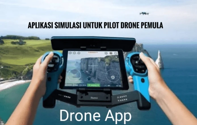
The hardware-software synergy is most evident in the applications provided by drone manufacturers. DJI, which currently holds over 70% of the global consumer drone market share, utilizes the DJI Fly and DJI Go 4 apps. these platforms serve as the primary interface for everything from camera settings and gimbal tilt to advanced "Intelligent Flight Modes." Features such as "ActiveTrack," "Point of Interest," and "Waypoints" allow even novice pilots to capture complex cinematic shots that would otherwise require a two-person crew.
However, many professional pilots find the manufacturer’s software to be restrictive for specific commercial needs. This has led to the rise of Litchi. Litchi is a third-party application compatible with many DJI drones that offers more robust waypoint mission planning. A pilot can plan a mission on a desktop computer, setting the exact coordinates, altitude, and camera angle for every second of the flight, and then sync it to the app. This is particularly useful for "time-lapse" projects where a pilot needs to fly the exact same path every week for six months to document the progress of a construction site.
For those operating Autel Robotics hardware, the Autel Explorer app provides a similar suite of professional tools. The competition between these platforms has driven a rapid evolution in software features, including obstacle avoidance visualizations and thermal imaging overlays for specialized enterprise drones used in search and rescue or agricultural health monitoring.
Post-Production and Creative Planning: The Final Stage
A successful drone mission does not end when the aircraft lands. The transition from raw data or footage to a finished product requires its own set of digital tools. For cinematographers, the "Golden Hour"—the period shortly after sunrise or before sunset—is the most coveted time for filming. PhotoPills and Sun Surveyor are two applications that allow pilots to predict the exact position of the sun and the length of shadows at any given location and time. This level of preparation ensures that a pilot doesn’t waste battery life waiting for the light to change; they arrive on-site exactly when the environment is most photogenic.
Once the footage is captured, mobile editing has become a viable workflow for social media content creators and journalists. Adobe Premiere Rush and CapCut have optimized their interfaces for high-resolution 4K drone footage, allowing for quick color correction, stabilization, and trimming. For more complex data needs, Google Earth remains a foundational tool for pre-flight site surveys. By viewing 3D topographies of a location, pilots can identify potential hazards like power lines or tall trees before they ever leave their office.
The Broader Impact: Safety Statistics and Legal Implications
The integration of these applications into standard operating procedures is not merely a matter of convenience; it is a matter of liability. Aviation authorities worldwide are increasingly looking at "pilot intent" and "due diligence" following accidents. A pilot who fails to check a TFR on an app like B4UFLY and subsequently wanders into a restricted area can face fines exceeding $20,000 and the revocation of their pilot certificate.
Data from various drone safety organizations suggests that a significant majority of "controlled flight into terrain" (CFIT) accidents and flyaway incidents occur when pilots bypass pre-flight checklists and software-based weather checks. By contrast, the commercial drone sector, which mandates the use of mission planning and airspace apps, maintains a safety record that rivals traditional general aviation.
Furthermore, the upcoming implementation of Remote ID—a "digital license plate" system for drones—will rely heavily on these applications. Pilots will need to ensure their software is updated to broadcast their location and identity to authorities, further cementing the role of the smartphone or tablet as an essential component of the drone’s cockpit.
Conclusion: The Future of the Connected Pilot
As we look toward the future of the "Advanced Air Mobility" (AAM) era, the line between a hobbyist drone and a professional aircraft continues to blur. The technology that allows a drone to stay stable in the air is mechanical, but the technology that allows it to be a productive, safe, and legal participant in the global airspace is digital.
Being a professional pilot in the 21st century requires a holistic approach. It starts with a meteorological assessment via UAV Forecast, continues with an airspace clearance through a LAANC-enabled app, proceeds with a precision-guided flight using Litchi or DJI Fly, and concludes with a data-driven analysis or cinematic edit. These applications are not optional accessories; they are the "digital mirrors" that allow a pilot to see beyond their line of sight, ensuring that every flight is not only successful but contributes to the continued safe integration of drones into our daily lives. For any pilot looking to elevate their craft, the investment in mastering these digital tools is just as important as the investment in the drone itself.