The rapid proliferation of Unmanned Aerial Vehicles (UAVs) has transformed industries ranging from cinematography and agriculture to infrastructure inspection and emergency response. However, as the skies become increasingly crowded, the responsibility of the pilot has evolved from simple manual control to the comprehensive management of a sophisticated aerial system. In the current regulatory and technological landscape, flying a drone without the support of specialized software is comparable to operating a motor vehicle without mirrors or a navigation system—it is inherently risky and professionally limiting. To ensure flight safety, legal compliance, and high-quality data acquisition, modern drone pilots must integrate a suite of essential applications into their standard operating procedures. These digital tools serve as the backbone of the "connected pilot," providing real-time data on airspace restrictions, meteorological conditions, and advanced flight telemetry.
The evolution of drone technology has seen a significant shift from hobbyist toys to professional-grade tools. According to industry reports, the global commercial drone market is projected to reach a valuation of over $50 billion by 2030. This growth is accompanied by stricter oversight from aviation authorities such as the Federal Aviation Administration (FAA) in the United States and the European Union Aviation Safety Agency (EASA). Consequently, the use of software that facilitates compliance and safety is no longer optional for those operating in professional or semi-professional capacities.
Navigational Integrity: Managing Restricted Airspace and Flight Zones
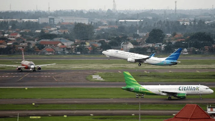
One of the most critical challenges facing a drone pilot is the avoidance of restricted airspace. Modern airspace is a complex web of Temporary Flight Restrictions (TFRs), No-Fly Zones (NFZs) around airports, and sensitive government installations. Entering these zones without authorization can lead to severe legal penalties, including heavy fines and the revocation of pilot certifications.
AirMap has long been a cornerstone of the drone industry, providing a comprehensive map of global airspace. The application offers real-time information regarding where it is safe to fly and where restrictions apply. More importantly, it has pioneered the integration of the Low Altitude Authorization and Notification Capability (LAANC), which allows pilots to receive near-instantaneous authorization to fly in controlled airspace at altitudes below 400 feet. This digital handshake between the pilot and Air Traffic Control (ATC) has revolutionized the efficiency of commercial operations.
Complementing this is B4UFLY, an initiative supported by the FAA. While primarily focused on the United States, its model of providing a simple "clear to fly" or "restricted" status based on GPS location has set a global standard for pre-flight safety checks. For pilots in international jurisdictions, similar regional apps provide data on local ordinances that might not be captured by global databases. The use of these tools is a primary defense against mid-air collisions with manned aircraft, a concern that remains at the forefront of aviation safety discussions.
Meteorological Precision: Mitigating Environmental Risks
The performance and safety of a UAV are directly dictated by environmental factors. Unlike commercial airliners that fly above most weather patterns, drones operate within the planetary boundary layer, where wind gusts, turbulence, and precipitation are most volatile.
UAV Forecast is widely regarded as the gold standard for drone-specific weather data. Unlike general weather apps, UAV Forecast provides specific metrics such as the "KP-index," which measures geomagnetic activity. High KP-index levels can interfere with GPS signals and onboard compasses, leading to "flyaways" or loss of control. Furthermore, the app allows pilots to check wind speeds at specific altitudes—crucial because wind speed at 200 feet is often significantly higher than at ground level.
Windy.com offers a broader but equally vital perspective. By utilizing high-resolution meteorological models like the ECMWF and GFS, Windy provides visual heat maps of wind gusts, cloud base heights, and rain accumulation. For a professional pilot, checking these apps is a mandatory step in the risk assessment process. A sudden gust exceeding a drone’s maximum tilt angle can result in a catastrophic crash, particularly in urban environments where "wind tunnel" effects between buildings are common.
Operational Control: Proprietary vs. Third-Party Flight Software
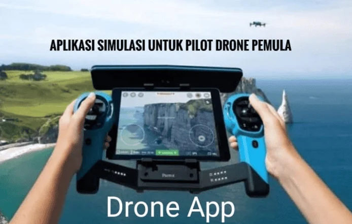
The interface between the pilot and the aircraft is the flight control application. While manufacturers like DJI and Autel provide robust proprietary software, third-party developers have filled niches for specialized missions.
For the majority of users, DJI Fly, DJI GO 4, or DJI Pilot are the primary gateways to their aircraft. these apps manage everything from camera settings and gimbal tilt to advanced "Intelligent Flight Modes" like ActiveTrack and Point of Interest. These modes allow a single operator to capture complex cinematic shots that would previously have required a dedicated camera operator.
However, for pilots seeking more granular control, Litchi has emerged as a powerful alternative. Litchi’s primary advantage is its advanced "Waypoint" mission planning. Pilots can program a flight path on a desktop computer, including specific camera angles and altitudes at each point, and then execute the mission autonomously in the field. This is particularly valuable for "before and after" shots in construction or for creating consistent time-lapse videos over several months.
In the industrial sector, DroneDeploy represents the pinnacle of automated flight for mapping and 3D modeling. By automating the flight path to ensure optimal image overlap, DroneDeploy allows pilots to create high-resolution orthomosaic maps and topographical models. This technology is currently being used to monitor crop health in precision agriculture and to calculate stockpile volumes in mining operations, significantly reducing the time and cost compared to traditional surveying methods.
Cinematography and Post-Processing: Elevating the Visual Narrative
The utility of a drone does not end when the aircraft lands. The data captured must be processed, edited, and shared. For many content creators, the ability to produce "social-ready" content in the field is a competitive advantage.
Adobe Premiere Rush and CapCut have become essential for mobile video editing. These apps allow pilots to trim 4K drone footage, apply color correction (LUTs), and add soundtracks directly from a tablet or smartphone. Given that drone footage often features high contrast between sky and ground, the ability to apply quick exposure adjustments in the field is invaluable.
For high-end photographers, Sun Surveyor and PhotoPills are indispensable planning tools. These applications allow a pilot to predict the exact position of the sun or moon at any given time and location. By using augmented reality (AR) views, a pilot can see exactly where the sun will set relative to a landmark, allowing them to time their flight for the "Golden Hour"—the period shortly after sunrise or before sunset when the light is soft, warm, and most flattering for aerial cinematography.
The Regulatory Landscape: Compliance and Official Responses
Aviation authorities have increasingly emphasized that "ignorance of the law is no excuse." In recent statements, FAA representatives have highlighted that the integration of Remote ID (a digital "license plate" for drones) and the use of approved flight planning apps are central to the safe integration of drones into the National Airspace System.
The shift toward digital documentation is also reflected in insurance requirements. Many commercial drone insurance providers now require pilots to maintain digital flight logs. Apps that automatically sync flight data—such as total flight time, battery cycles, and GPS paths—provide a transparent record that can be used for insurance claims or maintenance scheduling. This level of data logging ensures that the aircraft is airworthy and that the pilot is operating within the parameters of their professional liability coverage.
Future Implications: AI Integration and Autonomous Ecosystems
The future of drone applications lies in the integration of Artificial Intelligence (AI) and Machine Learning (ML). We are moving toward an era where apps will not just provide data but will offer predictive analytics. Future iterations of weather apps may automatically suggest flight window optimizations based on historical battery performance in specific temperatures.
Furthermore, as "Drone-in-a-Box" solutions become more prevalent for automated security and inspection, the role of the pilot will shift further toward that of a "mission commander" overseeing a fleet of autonomous units via cloud-based software. In this context, the applications discussed today are the foundational building blocks for a fully digitized and automated aerial ecosystem.
Conclusion: The Professional Standard of Aerial Operations
Becoming a proficient drone pilot requires more than just manual dexterity with a remote controller. It requires a commitment to a "safety-first" culture that leverages every available digital tool to mitigate risk and maximize output. The essential applications for drone pilots—spanning navigation, weather forecasting, flight control, and post-production—are not merely accessories; they are fundamental components of the aircraft’s operational capability.
By utilizing AirMap for compliance, UAV Forecast for environmental safety, and Litchi or DroneDeploy for mission precision, pilots can ensure that every flight is conducted with the highest degree of professionalism. As the technology continues to advance, the gap between hobbyist flying and professional aerial operations will only widen. Those who master the digital ecosystem surrounding their UAVs will be the ones who lead the industry into its next chapter of innovation and safety. For the modern pilot, the message is clear: prepare on the ground to excel in the air. Fly safe, fly smart, and always respect the shared sky.