
The strategic development of modern spiritual routes requires a meticulous blend of historical research, logistical planning, and environmental assessment. Recently, a formal reconnaissance mission was conducted to finalize a 15-mile pilgrimage route connecting the new town of Northstowe, located just outside Cambridge, to the historic Ely Cathedral. This "practice" pilgrimage was designed to evaluate the viability of the path, document key landmarks for instructional guides, and assess the physical demands of the journey under summer conditions. Led by a pioneer minister within the Church of England, the expedition highlighted the intersection of ancient tradition and contemporary community-building, while utilizing analog photography as a primary tool for environmental documentation and reflective analysis.
The Role of Pioneer Ministry in Modern Community Development
The pilgrimage project originates from the Northstowe Pioneer Ministry, an initiative focused on establishing a spiritual and social presence in one of the United Kingdom’s largest new town developments. Pioneer ministers are tasked with creating fresh expressions of church life that resonate with modern populations, often operating outside traditional parish structures. In the context of Northstowe—a town planned to eventually host 10,000 homes—the ministry seeks to foster a sense of identity and belonging through shared activities such as communal walking and historical exploration.
The planned pilgrimage to Ely Cathedral serves as a symbolic link between the nascent community of Northstowe and the deep religious heritage of Cambridgeshire. Ely Cathedral, often referred to as the "Ship of the Fens" due to its prominence on the flat horizon, has been a site of pilgrimage for over a millennium, centering on the shrine of Saint Etheldreda. By establishing a formal walking route from Northstowe, the ministry aims to provide residents with a tangible connection to the region’s historical narrative, promoting mental well-being and spiritual reflection through the practice of "slow travel."
Geographical and Environmental Context of the Fenland Route
The 15-mile route traverses the unique topography of the Cambridgeshire Fens, a landscape characterized by its low-lying reclaimed marshes and intricate network of man-made waterways. The reconnaissance took place during a period of significant heat, with temperatures reaching 27°C (80.6°F) following a prolonged summer drought. This environmental context provided critical data regarding the exposure of the route, the availability of shade, and the impact of heat on pilgrim stamina.
The Fenland landscape is a testament to human engineering. Historically a vast marshland, the area was drained starting in the 17th century to create some of the UK’s most fertile agricultural land. Consequently, the route follows a series of embankments, drainage channels, and riverbanks, specifically along the Great Ouse and the River Cam. The "Ship of the Fens" remains a constant visual anchor for the journey, visible from miles away, which provides a psychological target for walkers but also emphasizes the vast, open nature of the terrain.
Chronology of the Reconnaissance Expedition
The reconnaissance team opted to conduct the "recce" in reverse, starting at Ely and walking toward the Waterbeach station area to better understand the logistical challenges from both perspectives. The timeline of the 15-mile trek revealed several key milestones and infrastructural hurdles:
- Departure from Ely Cathedral: The journey began at the cathedral, moving southward toward the Great Ouse.
- Great Ouse Navigation: The team followed the river beneath the Ely southern bypass, a piece of modern infrastructure that contrasts sharply with the medieval cathedral.
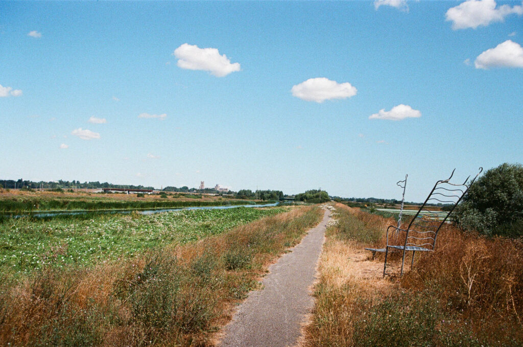
- The Southern Bypass Sculpture: Near the bypass, the team documented a large metal throne sculpture. This landmark was identified as a primary site for rest and reflection, offering a framed view of the cathedral for those approaching from the south.
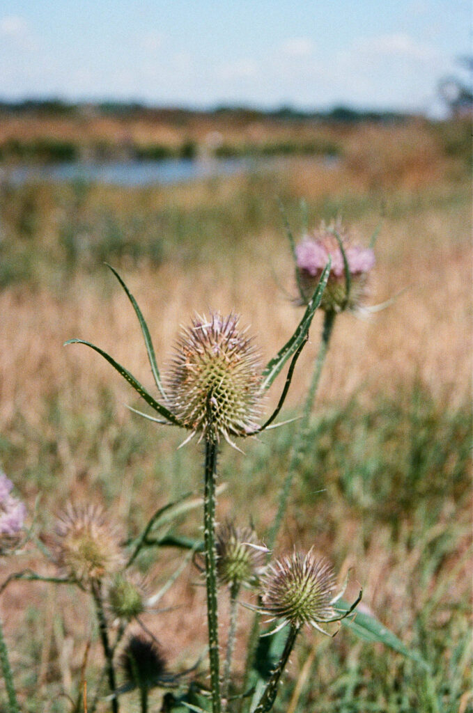
- Mid-Route Environmental Assessment: As the team moved into the heart of the Fens, they noted the prevalence of drought-resistant flora, such as thistles, which flourished despite the parched soil. This segment of the walk tested the accuracy of the proposed maps against the reality of the overgrown or "baked" paths.
- Infrastructural Obstacles: A significant finding during the expedition was a three-mile detour necessitated by a closed bridge. This unexpected change added nearly an hour to the travel time and highlighted the necessity of "live" updates for the final pilgrimage group.
- Bottisham Lock and the River Cam: The final stages of the walk involved navigating the sluices and locks of the River Cam. The team reached Bottisham Lock in the late afternoon, evaluating the site as a critical junction for water and rest.
- Conclusion at Waterbeach: The expedition concluded at Waterbeach, where the team assessed the proximity of rail links for pilgrims who might need to truncate their journey.
Technical Documentation and Analog Methodology
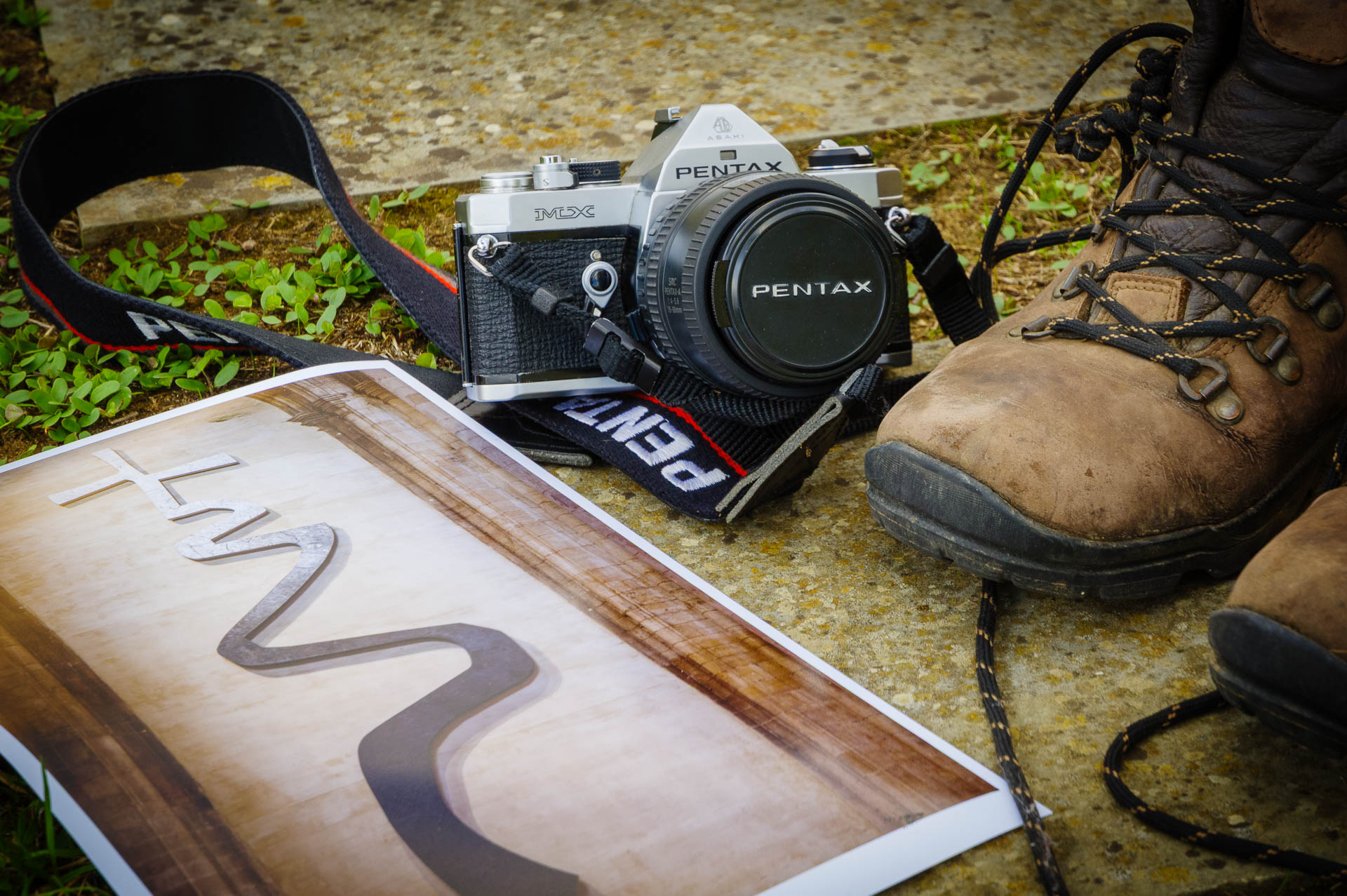
A distinctive aspect of this reconnaissance was the use of analog film photography for documentation. While digital photography is standard for modern route-mapping, the team employed a Pentax MX SLR equipped with an SMC-A 35-80mm f/4-5.6 zoom lens and Kodak Ultramax 400 film. This choice was not merely aesthetic but functional, aligning with the "pioneer" philosophy of noticing the ordinary and slowing the pace of observation.
The technical constraints of film photography—limited exposures and the absence of instant feedback—forced a more deliberate selection of subjects. During the walk, the camera’s internal light meter failed, requiring the documentation lead to utilize the "Sunny 16" rule. This manual exposure method involves setting the aperture to f/16 on a bright sunny day and matching the shutter speed to the film’s ISO (in this case, 1/400th of a second). The latitude of Kodak Ultramax 400, known for its "crunchy" grain and high saturation, proved sufficient for capturing the high-contrast summer landscape.
The resulting photographic record identified five critical "frames" or visual anchors for the pilgrimage guide:
- The Threshold: The metal chair sculpture overlooking the Great Ouse.
- The Micro-Landscape: Close-up studies of thistles, representing the beauty found in a harsh, drought-stricken environment.
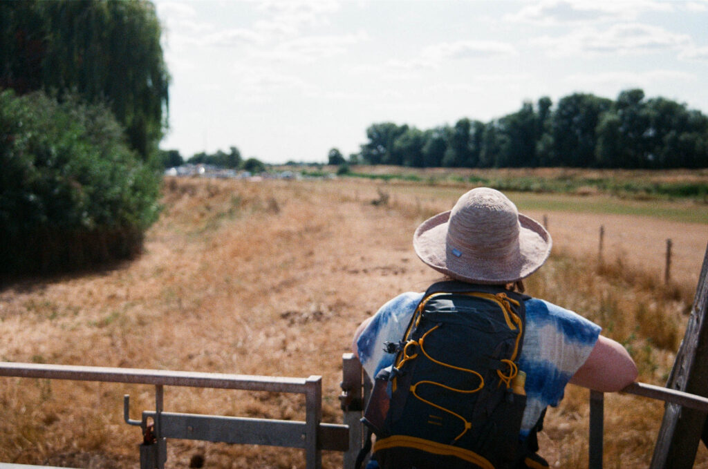
- The Human Element: Documentation of companionship and "pace-setting" through portraits of the fellow pilgrims.
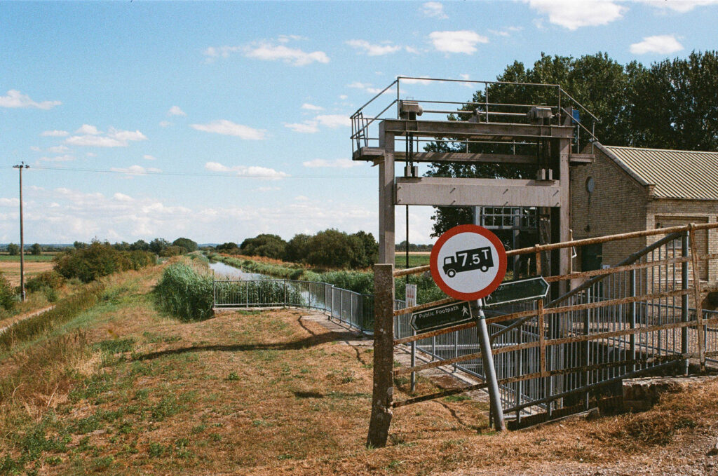
- The Infrastructure: A "wilting" signpost at a sluice gate, symbolizing the physical toll of the heat and the age of the Fenland wayfinding system.
- The Reflection: The mirrored sky in the waters of Bottisham Lock, highlighting the man-made nature of the "natural" landscape.
Infrastructure and Safety Analysis
The reconnaissance provided vital data for the safety briefing of the upcoming pilgrimage. The 27°C heat underscored the danger of heat exhaustion in a landscape with minimal canopy cover. Furthermore, the bridge closure near the River Cam emphasized the volatility of rural infrastructure.
Table 1: Logistical Findings of the Reconnaissance
| Feature | Observation | Recommendation for Pilgrims |
|---|---|---|
| Terrain | Flat, primarily grass and gravel embankments. | Sturdy walking shoes; avoid heavy boots if dry. |
| Shade Cover | Less than 10% of the route offers direct shade. | Mandatory hats, SPF 50+, and minimum 2L water. |
| Wayfinding | Some signs are faded or obscured by vegetation. | Use of GPS-enabled maps alongside printed guides. |
| Bridges/Locks | Subject to Environment Agency maintenance closures. | Check "River Cam Conservancy" alerts 24h prior. |
| Rest Points | Limited public seating; mostly natural or sculptural. | Lightweight portable mats recommended for seating. |
Broader Implications for Spiritual Tourism and Well-being
The development of the Northstowe-to-Ely route reflects a broader national trend in the United Kingdom: the resurgence of pilgrimage as a secular and spiritual activity. Organizations like the British Pilgrimage Trust have noted a significant increase in interest in long-distance walking routes that terminate at historic cathedrals. According to recent sociological data, these journeys are increasingly viewed as "holistic health" activities that combine physical exercise with "digital detoxing" and historical education.
For the Northstowe community, the pilgrimage serves a dual purpose. It is a "given" path—using existing rights of way and historical trajectories—but it is also "newly walked" by a population that is still defining its own local culture. The act of stopping to document a signpost or a flower is analyzed as a "reflective practice" that shifts the focus from the destination (Ely) to the journey itself.
In her subsequent pilgrimage guide, the pioneer minister noted that walking at a human pace allows for the "noticing" of things that disappear into the background at higher speeds. This philosophy is being integrated into the ministry’s outreach, suggesting that the "Ship of the Fens" is not just a destination to be reached, but a beacon that organizes the landscape and the thoughts of those moving toward it.
Conclusion
The successful reconnaissance of the Northstowe-to-Ely pilgrimage route has provided the necessary logistical and spiritual framework for the upcoming group event. By identifying the challenges posed by the Fenland environment—from the lack of shade to the unpredictability of river infrastructure—the Northstowe Pioneer Ministry has ensured a safer and more meaningful experience for future participants. The integration of analog photography has further enriched the project, creating a visual narrative that emphasizes the importance of "stopping" in an increasingly fast-paced world. As the new town of Northstowe grows, these established paths will likely become vital arteries of cultural and spiritual heritage, linking the modern resident to the ancient echoes of the Cambridgeshire landscape.