Ottawa, known as Odàwàg in the modern Algonquin language, stands as a critical intersection of Canadian history, governance, and urban development, situated on the south side of the Rideau River at the borders of Ontario and Québec. While the modern city was formally founded in 1826 as Bytown, archaeological evidence confirms that the Ottawa Valley has been habitable for over 10,000 years, serving as a vital hub for Indigenous populations. Roughly 6,000 years ago, the region supported robust trading networks, and 3,500-year-old evidence of continuously existing settlements highlights the area’s long-standing importance as a center of human activity. Today, as the capital of Canada, Ottawa serves not only as a political headquarters but also as a case study in the challenges of modernizing North American transit and preserving cultural heritage through changing economic climates.
The Evolution of the National Capital Region
The transformation of Ottawa from a rugged timber town into a G7 capital is a narrative of strategic geography. In 1857, Queen Victoria selected Ottawa as the permanent capital of the Province of Canada, largely due to its defensible location away from the American border and its position on the boundary between Canada West (Ontario) and Canada East (Québec). This dual identity remains a defining characteristic of the region. The city’s growth has been inextricably linked to its proximity to Gatineau, Québec, located just across the Ottawa River. While the Ontario side hosts the federal government and major national museums, the Gatineau side offers a distinct topographical shift, where the Canadian Shield begins to elevate the scenery into the lakes and mountains of South Québec.
Urban planners and historians often point to Bank Street as a microcosm of this evolution. As one of the city’s oldest and most significant commercial arteries, Bank Street stretches from the shadow of Parliament Hill southward through diverse neighborhoods including Centretown, the Glebe, and Old Ottawa South. The street reflects a broad spectrum of Canadian urban life, ranging from historic independent landmarks to modern government offices.
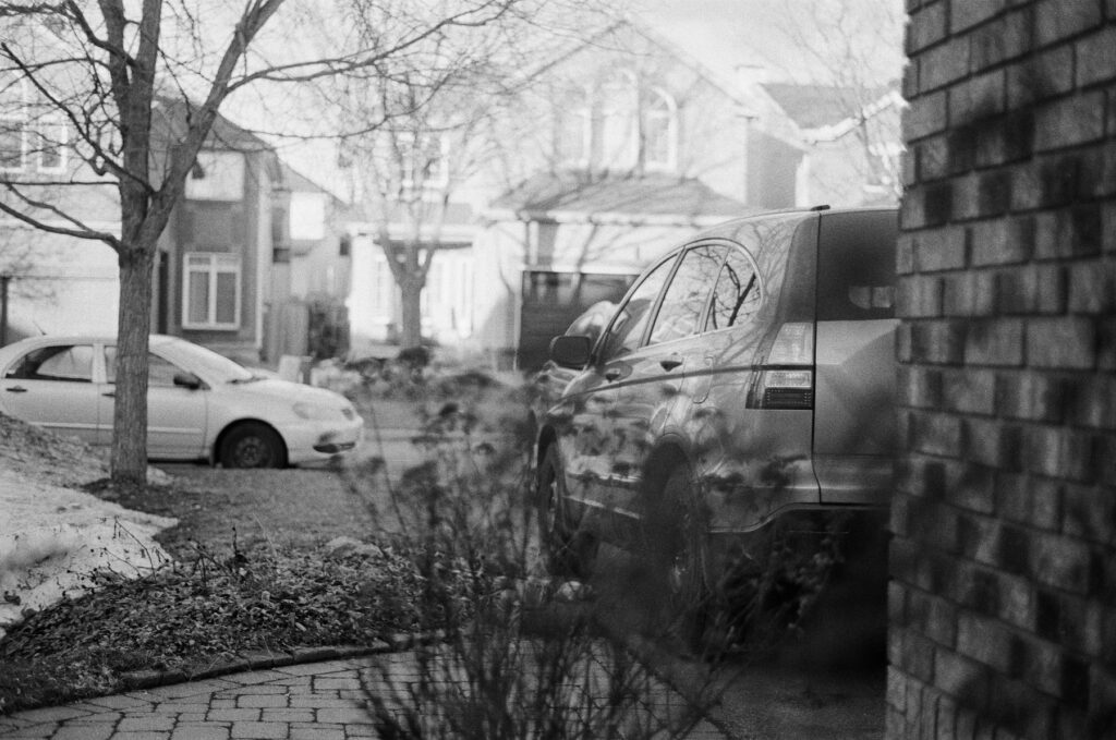
Transit Challenges and the High-Speed Rail Debate
A significant point of contention in the development of the National Capital Region is the state of transportation infrastructure connecting Ottawa to other major Canadian hubs. Currently, the journey from Toronto to Ottawa—the country’s first and fourth most populous metropolitan areas, respectively—takes approximately four hours by car under optimal weather conditions. However, the rail alternative, managed by VIA Rail, frequently faces reliability issues.
The existing rail corridor is hampered by several systemic factors. Much of the track is shared with freight trains, which often receive priority, leading to significant delays for passenger service. Furthermore, the fleet has historically suffered from age-related maintenance issues; until very recently, some rail cars in active service dated back to the 1940s and 1950s. While VIA Rail has begun the rollout of new Venture train sets from Siemens Mobility, advocacy groups like Transport Action Canada continue to lobby for more aggressive infrastructure investment.

The proposal for a "High-Frequency Rail" (HFR) corridor is currently under federal review. This project aims to create dedicated passenger tracks from Toronto through Ottawa to Montréal and Québec City. Proponents argue that such a corridor would revolutionize regional economics by providing a viable, low-carbon alternative to air travel and highway congestion. Critics and visionaries alike suggest that the scope should be even broader, potentially extending westward through Mississauga to the United States border, creating a seamless international link to Detroit and New York City. Such an expansion would integrate the "Windsor-Québec City Corridor," which houses over half of Canada’s total population.
Documentation through the Lens: The 1985 Minolta Revolution
In the realm of cultural documentation, the use of analog photography provides a unique perspective on Ottawa’s architectural and social texture. The choice of equipment, such as the Minolta Maxxum 7000, is significant within the history of industrial design and technology. Released in 1985, the Maxxum 7000 (known as the 7000 AF in Europe and the Alpha 7000 in Japan) was the world’s first successful autofocus (AF) single-lens reflex (SLR) camera with the AF system integrated into the body.
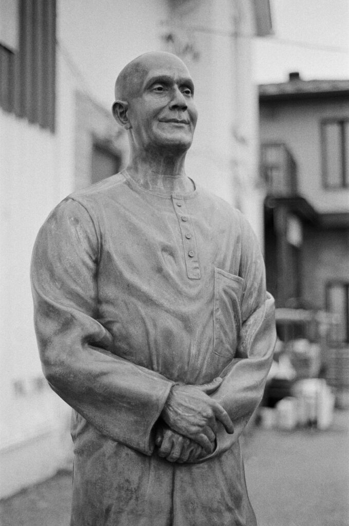
The Maxxum 7000 represented a paradigm shift in photography, moving away from the rugged, mechanical tanks of the 1970s toward the electronic, button-driven interfaces that define modern digital cameras. Despite being nearly 40 years old, these machines remain functional, though they are subject to the common failures of early-generation electronics, such as "leaky" liquid crystal displays (LCDs) and battery terminal corrosion. The camera’s reliance on standard AA batteries—a design choice that prioritized accessibility—continues to make it a favorite for street photographers documenting urban environments like Bank Street.
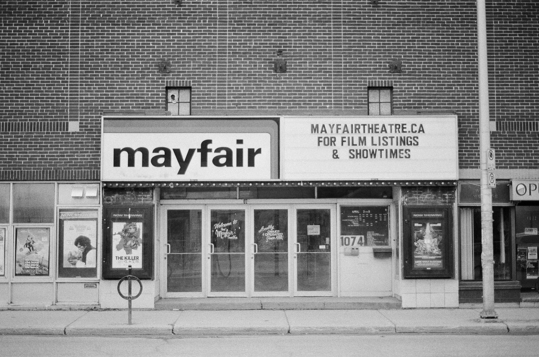
The technical pairing of vintage optics, such as the Minolta 50mm f/1.7, with discontinued film stocks like Fujifilm Neopan 400, creates a visual aesthetic that digital sensors often struggle to replicate. Neopan 400, a high-speed black-and-white film introduced in 1978 and discontinued in 2013, is noted for its "Presto" qualities in the Japanese market. Even when used as expired stock, it yields a high-contrast, grainy tonality that emphasizes the stark, often cold atmosphere of the Canadian capital during the winter months.
Cultural Landmarks and Social History on Bank Street
Bank Street is not merely a transit route but a site of profound social significance. One of the most notable locations on the street is the site of Canada’s first large-scale demonstration for equal rights for the LGBTQ+ community. On August 28, 1971, protesters gathered on Parliament Hill and marched through the city to present a list of demands to the federal government, marking a turning point in the nation’s civil rights history. Today, the area around Bank and Somerset Streets serves as the heart of Ottawa’s "Village," recognized by the city as a cultural and historical hub.
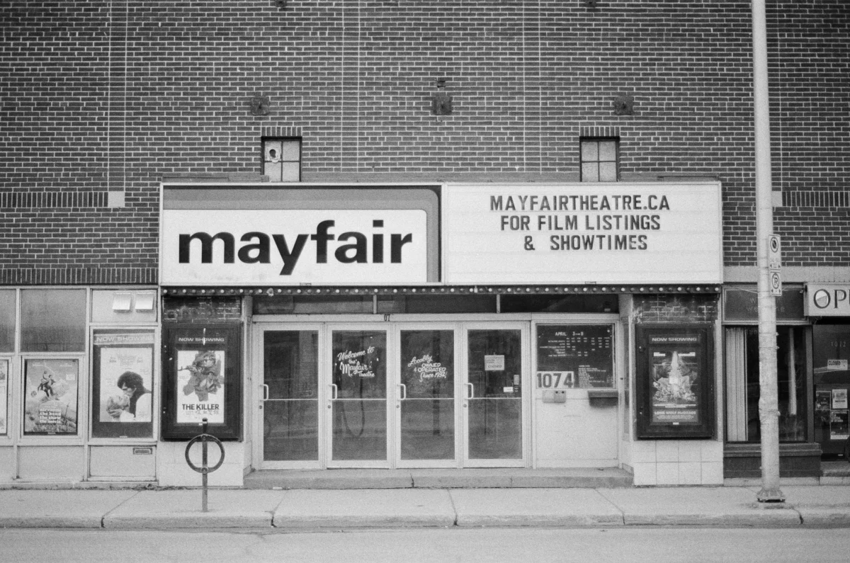
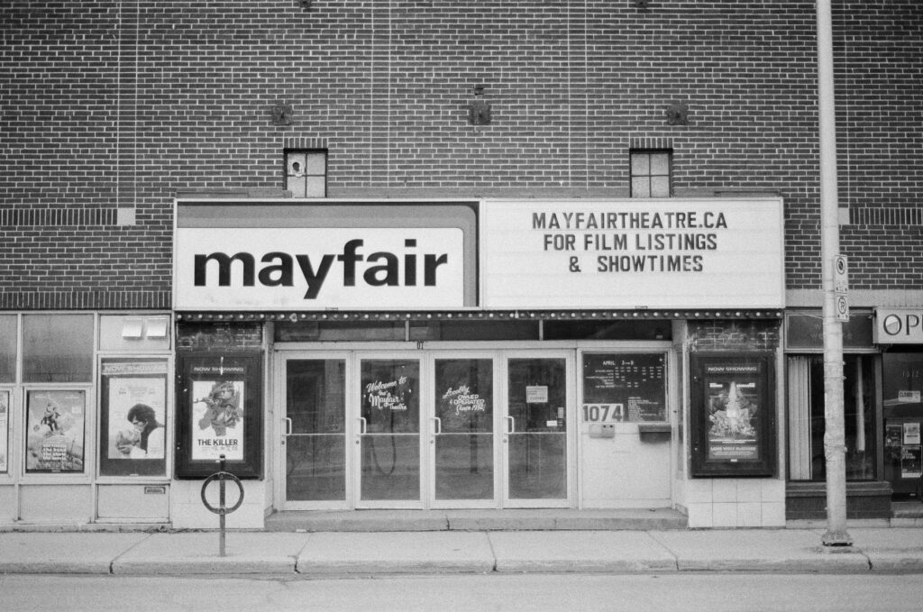
Further south, the street hosts the Mayfair Theatre, an independent cinema that has operated since 1932. As one of the oldest surviving independent movie houses in Canada, the Mayfair is a designated heritage building under the Ontario Heritage Act. Its survival in an era of multiplexes and streaming services is often cited by urban economists as a testament to the importance of "independent neighborhood anchors" in maintaining the vibrancy of a main street.
The street’s aesthetic is a study in contrasts:
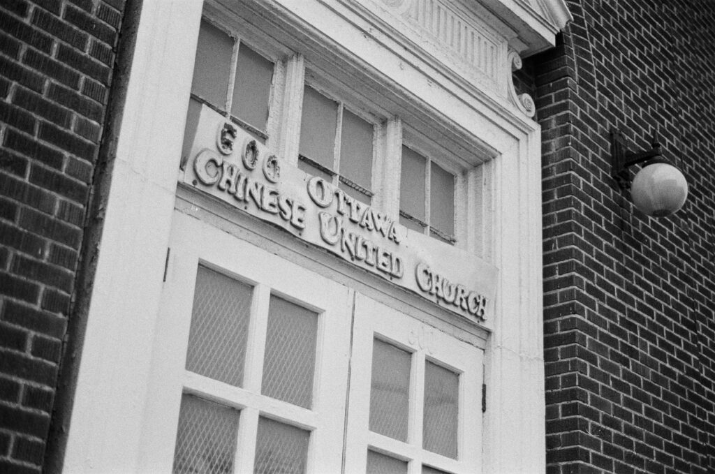
- The Chinese United Church: An architectural landmark that signifies the city’s multicultural heritage.
- Urban Murals: Strategic public art installations that attempt to soften the "brutalist" or "government-cold" reputation of Ottawa’s downtown core.
- The Glebe: A wealthy residential and commercial neighborhood where Bank Street narrows, featuring a high concentration of small businesses and "street food" establishments that have diversified the city’s culinary scene over the last decade.
Environmental and Economic Realities of the Winter Season
Ottawa’s climate plays a decisive role in its urban planning and tourism economy. Known as one of the coldest capitals in the world, the city’s winter season (roughly December through March) necessitates a specific type of resilience. The Rideau Canal, a UNESCO World Heritage site, becomes the world’s largest skating rink during this time, driving significant seasonal tourism. However, for the daily commuter or the street-level documentarian, the winter presents challenges including "grey-out" overcast skies and extreme temperatures that affect both human stamina and mechanical equipment.

Economic data suggests that while the city flourishes during events like Winterlude or Ottawa Senators (NHL) games, the retail environment on streets like Bank Street can suffer during prolonged cold snaps. The "walkability" of the city, a key metric for modern urban health, is severely tested by the icy conditions common to the valley. This environmental factor often colors the perception of the city for visitors and residents alike, reinforcing the need for the robust, indoor-connected transit solutions currently being debated in Parliament.
Broader Impact and Future Outlook
The intersection of Ottawa’s ancient Indigenous history, its 19th-century colonial architecture, and its 21st-century transit dilemmas creates a complex profile of a city in transition. The ongoing efforts to modernize the rail corridor and revitalize historic streets like Bank Street are essential for Ottawa to maintain its status as a world-class capital.
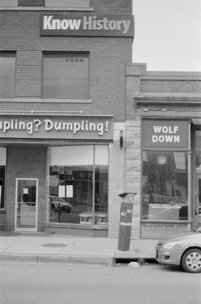
As the city continues to grow, the preservation of its "analog" history—whether through the protection of heritage theaters like the Mayfair or the continued use of vintage photographic technology to document its changes—serves as a vital link to the past. The "mysteries" of the city, from the ancient trading routes of the Algonquin to the mechanical quirks of a 1980s camera, all contribute to the narrative of a capital that is much more than a collection of government offices. It is a living, breathing urban center defined by its ability to endure the cold and evolve with the times.