The global Unmanned Aerial Vehicle (UAV) market has undergone a radical transformation over the last decade, evolving from a niche hobbyist pursuit into a multi-billion dollar industry spanning agriculture, construction, public safety, and high-end cinematography. As the skies become increasingly crowded, the distinction between an amateur operator and a professional pilot is no longer defined solely by the hardware they own, but by the digital ecosystem they utilize to ensure flight safety, regulatory compliance, and data precision. Navigating the modern airspace without a suite of dedicated applications is comparable to operating a motor vehicle without mirrors or a GPS—it is inherently risky, inefficient, and potentially illegal.
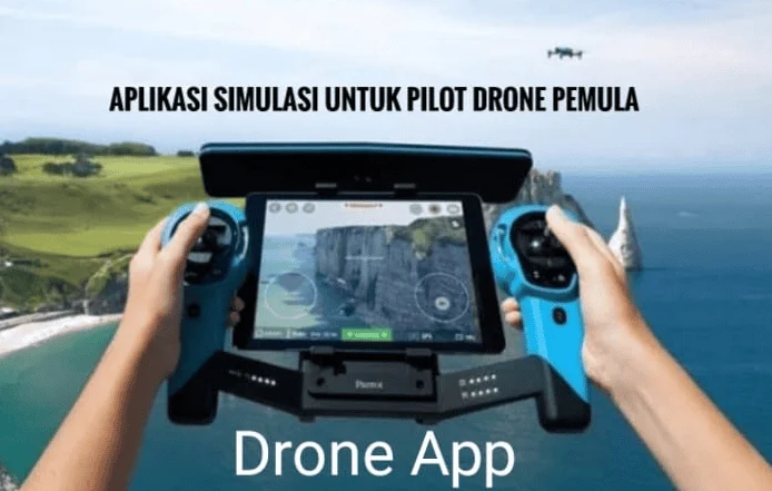
The integration of smartphone technology with drone hardware has birthed a new standard of "smart piloting." Today, a pilot’s mobile device serves as a secondary cockpit, providing real-time data on atmospheric conditions, restricted airspaces, and satellite health. This reliance on software is driven by the tightening of global aviation regulations, such as the Federal Aviation Administration’s (FAA) Part 107 in the United States and the European Union Aviation Safety Agency’s (EASA) drone framework. For pilots operating in diverse regions, including the rapidly growing Southeast Asian markets like Indonesia, staying informed through digital tools is the only way to mitigate the risk of heavy fines or catastrophic mid-air collisions.
The Foundation of Flight: Airspace Management and Regulatory Compliance
The most critical hurdle for any drone pilot is the complex web of controlled and uncontrolled airspace. Ignorance of flight restrictions is rarely accepted as a defense by aviation authorities. Consequently, airspace awareness applications have become the most essential tools in a pilot’s digital kit.
Historically, pilots had to manually check Sectional Charts—complex maps used by manned aircraft pilots—to determine if they were in a No-Fly Zone (NFZ). Today, applications like AirMap and B4UFLY have digitized this process. AirMap, a pioneer in the industry, provides real-time updates on Temporary Flight Restrictions (TFRs), which might be enacted due to sporting events, VIP movement, or wildfires. Furthermore, in jurisdictions that support it, AirMap allows pilots to request Low Altitude Authorization and Notification Capability (LAANC) approvals, granting near-instant access to controlled airspace that would have previously required weeks of paperwork.
B4UFLY, the official app developed through a partnership between the FAA and Aloft (formerly Kittyhawk), serves as the gold standard for situational awareness in the U.S., though its database is frequently referenced by international pilots to understand general safety parameters. For professional users, DroneDeploy offers a more specialized approach. While it is renowned for its mapping capabilities, its safety features allow for rigorous flight planning in industrial environments, ensuring that drones do not interfere with cranes, power lines, or other low-altitude obstacles common in construction and mining sectors.
Atmospheric Intelligence: Weather and Environmental Forecasting
While a drone may be mechanically sound, its performance is entirely dependent on the medium through which it travels. Wind speed, gust velocity, precipitation, and even solar activity can dictate the success or failure of a mission. Traditional weather apps like AccuWeather provide a general overview, but they lack the granular data required for UAV operations.
UAV Forecast is widely regarded as the most vital weather tool for pilots. Unlike standard apps, it provides a "Good to Fly" or "Not Recommended" status based on customizable parameters. It tracks the number of visible GPS satellites—a crucial metric for maintaining stable flight—and monitors the K-index, which measures geomagnetic storms. High solar activity can interfere with a drone’s compass and GPS, leading to "flyaways" where the pilot loses control of the aircraft.
Additionally, Windy.com has emerged as a favorite for professional cinematographers and long-range surveyors. Its sophisticated visualization of wind particles allows pilots to see "wind shear" at different altitudes. A drone might experience calm winds at ground level but face 40-knot gusts at 100 meters; Windy allows pilots to toggle altitude sliders to predict these conditions before they launch. This data is backed by the European Centre for Medium-Range Weather Forecasts (ECMWF) and the Global Forecast System (GFS), providing a level of accuracy that is essential for protecting expensive camera equipment.
Operational Control and Advanced Flight Automation
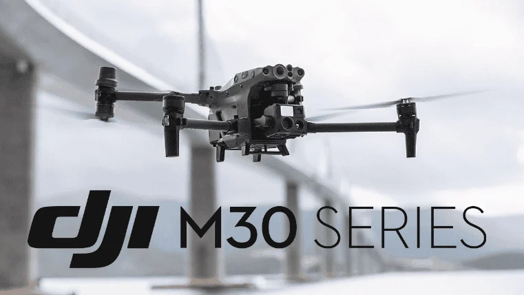
The hardware-software synergy is most evident in the control applications provided by manufacturers. DJI, which holds an estimated 70% of the global consumer drone market, utilizes a tiered application system: DJI Fly for consumer models like the Mini and Air series, DJI GO 4 for legacy prosumer models, and DJI Pilot for enterprise-grade thermal and mapping drones. These apps are the primary interface for telemetry, battery health monitoring, and camera settings.
However, the professional community often looks beyond native apps to unlock the full potential of their hardware. Litchi is a prominent third-party alternative that supports many DJI drones. Its primary advantage is its advanced waypoint mission planning. Pilots can program a flight path on a desktop computer, including specific camera angles and gimbal pitches at every point, and then sync it to their mobile device. This allows for perfectly repeatable shots—a necessity for time-lapse photography or visual effects (VFX) work where the same path must be flown at different times of the day.
For users of Autel Robotics hardware, the Autel Explorer app provides a similar suite of professional features, including 360-degree obstacle avoidance visualization and sophisticated "Dynamic Track" settings. The emergence of these robust control platforms has democratized high-end aerial cinematography, allowing a single operator to achieve shots that previously required a dedicated pilot and a separate camera operator.
Post-Production and Strategic Planning Tools
The job of a drone pilot does not end when the aircraft lands. The transition from raw footage to a professional deliverable requires a specific set of tools for data management and aesthetic refinement.
In the planning phase, Sun Surveyor and PhotoPills are indispensable for "Golden Hour" photography. These apps use augmented reality (AR) to overlay the sun’s path onto the pilot’s camera view. By knowing exactly where the sun will set or rise relative to a landmark, a pilot can schedule their flight to capture the most dramatic lighting possible. This level of preparation is what separates a casual snapshot from a professional-grade landscape photograph.
For rapid field editing, Adobe Premiere Rush and CapCut have become industry favorites. These mobile editors allow pilots to ingest high-bitrate 4K footage directly from their drone’s microSD card via a lightning or USB-C reader. Within minutes, a pilot can color-grade footage, add stabilization, and export a highlight reel for social media or client review. For more technical applications, Google Earth remains a staple for topographical scouting. Before even arriving at a site, a pilot can use Google Earth’s 3D view to identify potential takeoff locations, line-of-sight obstructions, and emergency landing zones.
Industry Analysis: The Shift Toward Integrated Ecosystems
Data from industry analysts at Drone Industry Insights suggests that the global drone market will reach an estimated $43 billion by 2025. This growth is being fueled by "Digital Transformation," where drones are integrated into the Internet of Things (IoT). The next evolution of drone applications will likely involve Artificial Intelligence (AI) that can automatically detect cracks in bridge infrastructure or count livestock in real-time.
Furthermore, the implementation of "Remote ID"—often described as a digital license plate for drones—is being integrated directly into these applications. In the United States and Europe, drones must now broadcast their identity and location. Apps like AirMap and Aloft are already updating their interfaces to allow pilots to verify their Remote ID status, ensuring that they remain visible to air traffic control and law enforcement. This transparency is seen as a necessary step toward the eventual integration of drones into the same airspace as commercial airliners.
Expert Insights and Safety Recommendations
Aviation safety experts emphasize that while these applications provide a wealth of data, they are not a substitute for pilot judgment. "The app is a tool, not a crutch," states one veteran flight instructor. "A pilot must still perform a physical pre-flight inspection and maintain visual line of sight."
To maximize the utility of these digital tools, professional pilots are encouraged to follow a strict protocol:
- Pre-Flight Scouting: Use Google Earth and PhotoPills to plan the "look" of the shoot 24 hours in advance.
- Airspace Verification: Check B4UFLY or AirMap for TFRs or local restrictions at the specific launch coordinate.
- Environmental Check: Use UAV Forecast one hour before launch to confirm wind and GPS satellite health.
- Firmware Integrity: Ensure that the control app (DJI Fly, Autel Explorer, etc.) is updated to the latest version to prevent software glitches mid-flight.
Conclusion
The modern drone pilot is more than just a remote-control operator; they are a data manager, a meteorologist, and a navigator. The "essential applications" discussed here form a digital safety net that protects the pilot’s investment, the public’s safety, and the integrity of the airspace. As drone technology continues to advance, the software will only become more integrated, moving toward a future where "detect and avoid" systems and automated traffic management are the norm.
By adopting these tools, pilots—whether they are hobbyists capturing a family vacation or professionals surveying a multi-million dollar infrastructure project—can ensure that every flight is conducted with the highest level of precision and professionalism. The sky is no longer a lawless frontier; it is a sophisticated digital environment, and these applications are the keys to navigating it successfully.