The global agricultural landscape is currently undergoing a profound transformation as traditional farming methods converge with cutting-edge aerospace technology, specifically the integration of Unmanned Aerial Vehicles (UAVs), commonly known as drones. For decades, the image of farming was inextricably linked to manual labor, heavy machinery like tractors, and ground-based observations that were often limited by the sheer scale of the land. However, the emergence of agricultural drones has introduced a "bird’s-eye view" that allows for precision, speed, and data-driven decision-making that was previously impossible. This technological shift is not merely a matter of convenience; it represents a critical response to the mounting pressures of global food security, labor shortages, and the increasing volatility of climate change.
The Technological Shift from Tradition to Precision Agriculture
The transition toward drone-integrated farming marks the beginning of what many experts call the "Third Green Revolution." While the first and second revolutions focused on mechanization and chemical enhancements, the third is defined by "Precision Agriculture." This methodology utilizes Information Technology (IT) and satellite/aerial data to ensure that crops and soil receive exactly what they need for optimum health and productivity.
In the early 2000s, drones were primarily the domain of military operations or high-end cinematography. By the mid-2010s, however, specialized manufacturers began adapting these platforms for commercial use. Today, the agricultural drone market is one of the fastest-growing sectors in the UAV industry. According to market research reports, the global agricultural drone market size was valued at approximately USD 4.5 billion in 2023 and is projected to expand at a compound annual growth rate (CAGR) of over 20% through 2030. This growth is driven by the urgent need to optimize crop yields as the world’s population approaches a projected 10 billion by the year 2050.
A Chronology of UAV Integration in Farming
The timeline of drone adoption in agriculture reveals a rapid evolution from simple observation tools to sophisticated, autonomous systems.
- The Early Adoption Phase (2010–2015): Early pioneers used modified hobbyist drones to capture aerial photographs of their fields. These images provided a basic perspective on crop health but lacked the data processing capabilities to be truly actionable.
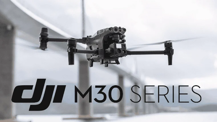
- The Sensor Revolution (2016–2019): This period saw the introduction of multispectral and thermal sensors. Drones could now "see" beyond the visible spectrum, detecting heat signatures and chlorophyll levels. Companies like DJI and PrecisionHawk began developing specialized agricultural platforms like the Agras series.
- The Automation and AI Era (2020–Present): Modern agricultural drones are now fully autonomous. They utilize Artificial Intelligence (AI) to map fields, identify specific pest infestations, and execute variable-rate spraying without human intervention. Integration with Internet of Things (IoT) sensors on the ground has created a seamless ecosystem of farm management.
Core Functional Applications Enhancing Operational Efficiency
The versatility of drones allows them to perform a wide array of tasks that were once labor-intensive, expensive, or dangerous.
Comprehensive Field Mapping and Real-Time Monitoring
The most widespread use of drones is for field mapping. Equipped with high-resolution cameras, drones can fly over hundreds of hectares in a single afternoon. The resulting data is stitched together into orthomosaic maps—detailed, 2D representations of the entire farm. These maps allow farmers to identify "stress zones" where plants may be suffering from nitrogen deficiency, water stress, or fungal infections. By identifying these issues early, farmers can intervene before the problem spreads, potentially saving an entire season’s harvest.
Precision Spraying and Resource Optimization
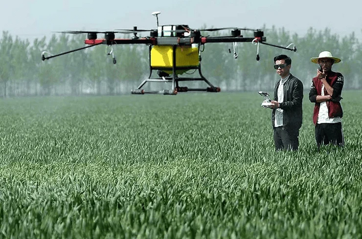
One of the most significant advancements is the drone-based application of liquid fertilizers and pesticides. Traditional spraying methods, whether via tractor or manual backpack sprayers, often result in significant waste and uneven distribution. Drones equipped with ultra-low volume (ULV) spray technology can apply chemicals with centimeter-level precision. Data suggests that drone spraying can reduce chemical usage by up to 30% and water consumption by up to 90% compared to traditional methods. Furthermore, because the drone flies above the crop, it eliminates the "soil compaction" caused by heavy tractors, which can damage the root systems and reduce yield.
Multispectral Analysis and Crop Health Assessment
Beyond standard photography, drones utilize multispectral imaging to measure the Normalized Difference Vegetation Index (NDVI). This index calculates the difference between near-infrared (which vegetation strongly reflects) and red light (which vegetation absorbs). A high NDVI value indicates healthy, photosynthesis-active plants, while a low value suggests distress. This allows for "variable rate application," where a farmer only applies fertilizer to the specific areas that need it, rather than treating the entire field uniformly.
Supporting Data: The Economic and Environmental Case
The adoption of drone technology is supported by compelling data regarding Return on Investment (ROI) and environmental sustainability. A study conducted in Southeast Asia on rice paddy cultivation showed that using drones for pesticide application reduced the time required for a 10-hectare plot from two days (manual labor) to less than an hour.
Furthermore, the environmental impact is substantial. By reducing the volume of chemicals used, drones prevent excessive runoff into local water supplies, mitigating the risk of eutrophication and groundwater contamination. In terms of labor, as rural populations migrate to urban centers, drones fill a critical gap in the workforce, allowing a single operator to manage the same acreage that once required a dozen workers.
Institutional Responses and Regulatory Landscapes
Governments and international organizations have begun to recognize the strategic importance of agricultural drones. In India, the "Kisan Drone" initiative has provided subsidies to farmers and cooperatives to encourage adoption. In the United States, the Federal Aviation Administration (FAA) has streamlined Part 107 waivers for agricultural operations, recognizing that these drones typically fly at low altitudes over unpopulated areas, posing minimal risk to national airspace.
However, challenges remain. Industry experts point out that the high initial capital expenditure—ranging from $5,000 to over $30,000 for professional-grade systems—remains a barrier for smallholder farmers in developing nations. To combat this, "Drone-as-a-Service" (DaaS) models have emerged. In these models, specialized companies provide the drone and the pilot on a contract basis, allowing farmers to benefit from the technology without the burden of ownership and maintenance.
Analysis of Challenges and Future Implications
Despite the rapid growth, the "drone revolution" faces several hurdles that will define the next decade of development.
- Technical Literacy: Operating a sophisticated UAV and interpreting multispectral data requires a level of technical expertise that many traditional farmers may not possess. This has led to a surge in specialized vocational training programs.
- Data Connectivity: Drones generate massive amounts of data. In remote rural areas where 5G or even 4G connectivity is lacking, uploading and processing this data in the cloud remains a logistical challenge.
- Battery Life and Flight Time: Most multi-rotor drones are limited to 20–40 minutes of flight time. For massive industrial farms, this necessitates frequent battery swaps, though advancements in hydrogen fuel cells and hybrid engines are beginning to address this limitation.
Looking forward, the integration of drones with AI-driven predictive analytics will likely be the next frontier. Future systems will not just tell a farmer that a plant is sick; they will predict a pest outbreak weeks in advance based on historical weather patterns and satellite data, automatically deploying a drone to treat the specific entry point of the infestation.
Conclusion: A New Era of High-Tech Husbandry
The ascent of drones into the agricultural sector represents a pivotal moment in human history. By bridging the gap between the soil and the sky, these machines are enabling a more resilient, efficient, and sustainable food production system. While the drone was once viewed as a gadget for the tech-savvy or a tool for the military, its role as a "pahlawan kecil" (little hero) in the fields is now undeniable.
As technology continues to mature and costs decrease, the sight of a drone hovering over a field will become as common as the sight of a tractor in the 20th century. The future of agriculture is no longer tethered solely to the earth; it is increasingly defined by the data gathered and the actions taken from the air. In an era of climate uncertainty and a growing global population, the drone is not just a luxury—it is becoming an essential instrument in the quest to feed the world.