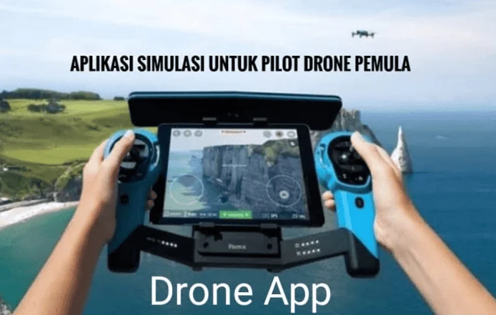
The rapid proliferation of Unmanned Aerial Vehicles (UAVs), commonly referred to as drones, has transitioned from a niche hobbyist pursuit into a multi-billion dollar global industry spanning agriculture, construction, cinematography, and emergency services. As the complexity of drone technology increases, so too does the necessity for a sophisticated digital infrastructure to manage flight safety, regulatory compliance, and data acquisition. For the modern pilot, the aircraft itself is only half of the equation; the "second cockpit"—the suite of applications residing on a pilot’s smartphone or tablet—is now a mandatory requirement for professional and safe operation. Operating a drone without these digital tools is no longer merely a disadvantage but a significant liability that risks equipment failure, legal repercussions, and airspace violations.
The Evolution of the Drone Digital Ecosystem
The integration of software into drone piloting has undergone a significant transformation over the last decade. In the early 2010s, flight was largely manual, relying on radio frequencies and visual line-of-sight (VLOS) with minimal telemetry. However, as the Federal Aviation Administration (FAA) in the United States and the European Union Aviation Safety Agency (EASA) began formalizing regulations, the industry saw a shift toward data-driven flight management.
Today, the digital ecosystem for pilots is categorized into four critical pillars: airspace awareness and compliance, meteorological forecasting, flight control and automation, and post-flight data processing. This comprehensive approach ensures that every mission, whether for a high-budget film or a routine roof inspection, adheres to the highest standards of safety and efficiency.
Airspace Awareness and Regulatory Compliance
The most critical challenge for any drone pilot is navigating the invisible boundaries of controlled airspace. Unauthorized entry into restricted zones—such as those surrounding airports, military installations, or temporary flight restriction (TFR) areas—can result in heavy fines and the revocation of pilot certifications.
1. AirMap and the Integration of LAANC
AirMap has emerged as a cornerstone for professional operators by providing real-time digital maps that identify no-fly zones and advisory areas. One of its most significant contributions to the industry is its integration with the Low Altitude Authorization and Notification Capability (LAANC). This system allows pilots to receive near-instantaneous authorization from the FAA to fly in controlled airspace under 400 feet, a process that previously took weeks via manual paperwork.
2. B4UFLY and Regulatory Oversight
The B4UFLY app, developed through a partnership between the FAA and private enterprise (currently powered by Aloft), serves as the primary tool for recreational and commercial pilots to check their immediate surroundings. According to FAA data, the agency has seen a steady decrease in inadvertent airspace violations since the wide-scale adoption of such applications. The app provides a simple "green, yellow, or red" status, making complex aeronautical charts accessible to the general public.
3. DroneDeploy for Industrial Mapping
While often categorized under mapping, DroneDeploy plays a vital role in site safety. For professionals in construction and agriculture, it allows for the creation of high-resolution orthomosaic maps. By automating the flight path, it removes human error from the navigation process, ensuring that the drone stays within the pre-defined project boundaries.
Meteorological Precision and Risk Mitigation
A drone is essentially a flying computer, and like all electronics, it is highly susceptible to environmental factors. Weather-related incidents remain a leading cause of drone "flyaways" and crashes.
4. UAV Forecast: The Pilot’s Pre-Flight Standard
UAV Forecast is widely regarded as the most essential weather tool for drone pilots. It provides more than just temperature and rain chances; it delivers data on the Kp-index (which measures geomagnetic activity that can interfere with GPS signals), wind speeds at various altitudes, and the number of visible satellites. Industry safety reports suggest that checking the Kp-index is vital for preventing "toilet bowl" effects, where a drone loses its GPS lock and begins spiraling uncontrollably.
5. Windy: Advanced Atmospheric Visualization
Windy.com offers a sophisticated visualization of wind currents, pressure systems, and cloud cover. For long-range missions or those involving high-altitude photography, understanding wind shear—the difference in wind speed and direction at different heights—is crucial. A drone may experience calm winds at ground level but face 30-knot gusts at 300 feet, which can rapidly deplete battery life or cause structural failure.
Advanced Flight Control and Proprietary Software
The software used to physically control the drone acts as the interface between the pilot’s intentions and the aircraft’s hardware. While manufacturers provide native apps, third-party developers often offer more robust features for specific professional needs.
6. The DJI Ecosystem: Fly, GO 4, and Pilot
As the market leader with over 70% of the global drone market share, DJI’s software suite is the industry standard. The DJI Fly app is designed for consumer-grade drones like the Mini and Air series, focusing on ease of use and cinematic "Quickshots." In contrast, DJI Pilot is tailored for enterprise users, supporting thermal imaging, dual-camera setups, and mission planning for search and rescue operations.
7. Litchi: Unlocking Automation
For many professional cinematographers, Litchi is the preferred alternative to DJI’s native apps. It allows pilots to program complex "waypoint" missions on a desktop and sync them to their mobile device. This level of precision enables identical flight paths to be flown multiple times, which is essential for time-lapse photography or complex VFX shots where multiple takes must align perfectly.
8. Autel Explorer
Competing directly with DJI, Autel Robotics provides the Autel Explorer app for its Evo series. Known for its lack of "geofencing" (software-based flight restrictions), Autel relies more heavily on the pilot’s responsibility to follow the law. This makes their software particularly popular among government and public safety agencies who may need to fly in restricted areas during emergencies without waiting for software unlocks.
Post-Production, Data Management, and Planning
The value of a drone flight is often found in the data collected after the aircraft has landed. Efficiently processing this data is what separates a hobbyist from a professional service provider.
9. Mobile Editing: Adobe Premiere Rush and CapCut
The demand for "instant" content has led to the rise of mobile-first editing. Apps like Adobe Premiere Rush and CapCut allow pilots to download high-definition footage directly from the drone to their tablet and edit professional-grade videos for social media or client previews within minutes of landing. This speed is particularly valuable in the real estate and news sectors.
10. Strategic Planning: Google Earth and PhotoPills
Before a pilot even arrives at a location, tools like Google Earth are used for "virtual scouting." By examining 3D topographies, pilots can identify potential obstacles like power lines or tall trees that might not be visible from the ground. Furthermore, apps like PhotoPills and Sun Surveyor allow pilots to predict the exact position of the sun or moon at any given time. This "Golden Hour" planning is essential for high-end architectural photography, ensuring that shadows and lighting enhance the subject matter.
The Broader Impact: Data-Driven Safety and Industry Growth
The integration of these applications has a profound impact on the safety statistics of the National Airspace System (NAS). According to recent industry analysis, the use of automated flight and airspace awareness apps has contributed to a 15% year-over-year improvement in incident-free flight hours for commercial operators.
Moreover, the data collected by these apps is being used by regulators to shape the future of flight. Remote ID, a new requirement that acts as a digital license plate for drones, is being integrated into many of these platforms. This allows law enforcement to identify drones in real-time, fostering a culture of accountability that is necessary for the eventual approval of Beyond Visual Line of Sight (BVLOS) missions.
Conclusion: The Professional Requirement for a Digital Toolkit
In conclusion, becoming a proficient drone pilot in the modern era requires a mastery of both the physical aircraft and the digital tools that support it. The "essential apps" discussed are not merely conveniences; they are the pillars of a professional operation. They provide the situational awareness needed to avoid collisions, the meteorological data needed to protect expensive hardware, and the creative tools needed to deliver high-quality results.
As the industry moves toward 5G connectivity and AI-driven autonomy, the reliance on these digital ecosystems will only increase. For the pilot, staying updated on the latest software developments is just as important as maintaining the drone’s rotors and batteries. By leveraging these applications, pilots can ensure that their operations remain safe, legal, and at the forefront of the technological curve, ultimately respecting the shared airspace and the communities they fly over.