The Evolution of the Digital Flight Kit: A Chronological Context
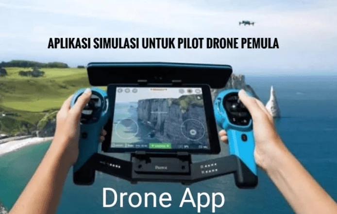
The reliance on mobile applications has evolved in tandem with the hardware capabilities of the drones themselves. In the early 2010s, drone flight was largely manual, requiring pilots to possess significant mechanical knowledge and rely on visual line of sight without the aid of GPS stabilization.
- 2010–2013: The introduction of the Parrot AR.Drone and the DJI Phantom series marked the beginning of app-integrated flight. Initially, these apps were rudimentary, providing only basic telemetry and a grainy video feed.
- 2016: The Federal Aviation Administration (FAA) in the United States implemented Part 107, the first major set of regulations for commercial drone use. This sparked a "gold rush" in app development as pilots needed ways to prove compliance and check for Restricted Operating Zones (ROZs).
- 2018–2021: The rise of LAANC (Low Altitude Authorization and Notification Capability) allowed for near-instant flight authorization in controlled airspace. Apps like AirMap and Kittyhawk (now Aloft) became the industry standard for professional operators.
- 2023–Present: The implementation of Remote ID mandates in various jurisdictions has forced a new wave of software updates, requiring apps to handle complex identification protocols and broadcast data to ensure national security and safety.
Navigational Integrity and Airspace Management
The primary responsibility of any drone pilot is the safety of the National Airspace System (NAS). Navigational applications provide a layered view of the sky, identifying temporary flight restrictions (TFRs), proximity to airports, and sensitive government installations.
1. Aloft (Formerly Kittyhawk) and B4UFLY
Following the partnership between the FAA and private software developers, B4UFLY became the gold standard for situational awareness. While the original B4UFLY app provided a simple "Good to Go" or "Do Not Fly" status, its integration into the Aloft platform has provided pilots with a more robust toolset. Aloft allows commercial pilots to apply for LAANC authorization in real-time, enabling flights in controlled airspace that previously required months of manual paperwork. According to industry data, LAANC has processed over one million authorizations since its inception, significantly reducing the rate of unauthorized incursions.
2. AirMap
AirMap remains a critical tool for international pilots. It provides a comprehensive map of worldwide airspace rules and allows users to create flight plans that adhere to local regulations. Its "Digital Notice and Awareness System" (D-NAS) enables airports to see where drones are operating in their vicinity, creating a two-way communication channel that enhances safety for manned aviation.
3. DroneDeploy
For the professional sector, DroneDeploy represents the shift from simple photography to high-level data acquisition. This application automates the flight path of the drone to capture a series of overlapping images, which are then stitched into 3D models or 2D orthomosaic maps. In industries like construction, this technology is used to track progress and calculate volumes of materials with an accuracy margin of less than 1%.
Meteorological Analysis and Environmental Readiness
Weather is the single most significant external factor in UAV operations. A drone’s flight controller can compensate for some wind, but sudden gusts or solar activity can lead to catastrophic hardware failure or "flyaways."
4. UAV Forecast
UAV Forecast is considered the "pre-flight bible" for pilots. Unlike standard weather apps, it provides specific data points relevant to flight:
- Wind Speed at Altitude: Surface wind is often significantly lower than wind at 100 or 400 feet. UAV Forecast calculates these gradients.
- K-Index (Solar Activity): High solar activity can interfere with GPS signals and onboard compasses. A K-Index above 4 is generally considered risky for professional operations.
- Satellite Lock: The app predicts how many GPS and GLONASS satellites will be visible at a specific time and location, ensuring the drone has a stable "home point" lock.
5. Windy.com
While not drone-specific, Windy is utilized by long-range and high-altitude pilots for its sophisticated visualization of wind particles and pressure systems. It allows pilots to view "wind shear" layers, which is vital for those operating heavy-lift drones that carry expensive cinema cameras.
Advanced Operational Control and Cinematography
While manufacturers like DJI and Autel provide proprietary apps, third-party developers often unlock features that the original equipment manufacturers (OEMs) do not prioritize.
6. The DJI Ecosystem (DJI Fly, GO 4, and Pilot 2)
The vast majority of the global drone fleet is controlled via DJI software. The "DJI Fly" app is designed for consumer-grade drones like the Mini and Air series, focusing on ease of use. In contrast, "DJI Pilot 2" is an enterprise-level tool used for thermal imaging, search and rescue, and industrial inspections. These apps include "Geofencing" technology, which prevents the drone from taking off in high-security areas like the White House or major international airports.
7. Litchi
Litchi has gained a cult following among professional cinematographers because it allows for "Waypoints"—pre-programmed flight paths that the drone follows autonomously. This enables a pilot to focus entirely on the camera’s gimbal movements while the drone flies a perfectly smooth, repeatable line. This is particularly useful for "hyperlapse" photography or complex shots that require multiple takes.
8. Autel Explorer
For pilots who prefer the Autel Robotics ecosystem (often chosen for its lack of restrictive geofencing), the Explorer app provides a professional-grade interface. It is frequently used in public safety sectors where "no-fly zone" overrides are necessary for emergency response missions.
Post-Production and Pre-Visualization Tools
The work of a drone pilot does not end when the aircraft lands. Managing the data captured and planning for the "perfect shot" requires a different set of digital tools.
9. PhotoPills and Sun Surveyor
Lighting is the essence of cinematography. These applications use Augmented Reality (AR) to show the pilot exactly where the sun or moon will be at any given time. For a drone pilot looking to capture a "Golden Hour" shot over a specific landmark, these apps allow them to calculate the exact minute they need to be in the air to get the desired shadow lengths and color temperatures.
10. Adobe Premiere Rush and CapCut
In the age of social media and rapid news cycles, the ability to edit 4K drone footage on-site is invaluable. These mobile editors allow for high-speed proxy editing and direct color grading, enabling a pilot to deliver a finished product to a client or news desk within minutes of landing.
Analysis of Implications: Safety, Insurance, and Liability
The integration of these applications into daily workflows has profound implications for the insurance and legal landscape of the drone industry. Insurance providers, such as SkyWatch.AI or Verifly, now often require flight logs—generated by these apps—to settle claims. If a pilot crashes a drone and cannot provide a log showing they checked the weather (via UAV Forecast) or checked the airspace (via B4UFLY), the insurance claim may be denied on the grounds of negligence.
Furthermore, the data collected by these apps is becoming a part of the "Digital Twin" of the sky. Governments are increasingly looking at app data to understand drone traffic patterns to prepare for the future of "Urban Air Mobility" (UAV taxis and delivery drones).
Industry Statements and Expert Perspectives
Industry analysts suggest that the "app-ification" of flight is the first step toward full autonomy. "We are moving away from a world where the pilot is a stick-and-rudder operator to a world where the pilot is a mission commander," says a spokesperson from a leading UAV consultancy firm. "The software is now doing 90% of the heavy lifting regarding safety and navigation. The human is there to make high-level decisions."
Regulatory bodies have also weighed in, noting that the ease of use provided by these apps has significantly lowered the barrier to entry for commercial work, which in turn necessitates stricter oversight. The FAA’s emphasis on LAANC integration within these apps is a testament to the government’s recognition that mobile software is a primary tool for maintaining order in the skies.
Conclusion: The Professional Standard
Being a proficient drone pilot in the modern era requires a multifaceted approach to technology. It is no longer enough to simply "know how to fly." A professional must be part meteorologist, part navigator, part cinematographer, and part data analyst.
The suite of applications discussed—ranging from the navigational precision of Aloft to the environmental insights of UAV Forecast and the creative freedom of Litchi—forms a comprehensive ecosystem that ensures every flight is conducted with the highest levels of safety and efficiency. As drone hardware continues to plateau in terms of flight time and camera quality, the real innovation is happening in the software. For those looking to excel in this field, mastering these digital tools is the only way to ensure a flight that is not only successful but also legally and professionally sound. The future of flight is digital, and for the modern pilot, that future is contained within the palm of their hand.