The global Unmanned Aerial Vehicle (UAV) market has transitioned from a niche hobbyist sector into a multi-billion-dollar industry, necessitating a sophisticated digital ecosystem to manage the complexities of modern airspace. As drone technology advances, the reliance on mobile applications has become a non-negotiable aspect of flight operations, serving as the bridge between hardware capabilities and regulatory compliance. For the modern pilot, flying without a suite of specialized applications is increasingly viewed as a high-risk endeavor, comparable to operating a traditional aircraft without navigational charts or meteorological reports. The integration of these digital tools is no longer just about convenience; it is a fundamental requirement for maintaining safety, optimizing efficiency, and ensuring the longevity of expensive aerial equipment.
The Evolution of Drone Flight Management and Regulatory Integration
The history of drone flight has moved rapidly from manual "line-of-sight" operation to highly automated, data-driven missions. In the early 2010s, pilots relied largely on instinct and basic telemetry. However, as the skies became more crowded, civil aviation authorities worldwide, such as the Federal Aviation Administration (FAA) in the United States and the Directorate General of Civil Aviation (DGCA) in Indonesia, began implementing stricter frameworks. This led to the development of the Low Altitude Authorization and Notification Capability (LAANC), a system that automates the application and approval process for airspace authorizations.
Applications like AirMap and B4UFLY emerged as the primary interfaces for this regulatory shift. These platforms provide real-time data on Temporary Flight Restrictions (TFRs), No-Fly Zones (NFZs), and proximity to airports. For professional pilots, the ability to receive near-instant authorization to fly in controlled airspace via these apps has revolutionized the industry, reducing what used to be a weeks-long manual paperwork process into a few taps on a smartphone screen.
Strategic Navigational Tools and Airspace Awareness
The cornerstone of any safe drone mission is situational awareness. AirMap remains a dominant force in this category, offering a comprehensive view of the national airspace system. It provides pilots with advisory information regarding nearby wildfires, sporting events, and other dynamic hazards. Furthermore, its digital authorization features allow for seamless integration with local air traffic control in supported regions.
Parallel to this is B4UFLY, an essential tool for both recreational and commercial operators. While originally developed by the FAA, its utility has expanded through partnerships with private technology firms like Aloft (formerly Kittyhawk). The app simplifies the complex "Can I fly here?" question by using a color-coded status system. In the context of Indonesian airspace, while specific local apps are in development, these international standards provide a crucial baseline for pilots navigating the increasingly regulated urban environments of Jakarta, Surabaya, and Bali.
For those involved in industrial applications, DroneDeploy represents the pinnacle of mission-specific navigation. This application is not merely a flight tool but a comprehensive mapping platform. It allows pilots to automate flight paths for photogrammetry, creating high-resolution 2D maps and 3D models of construction sites or agricultural fields. The data collected via DroneDeploy is often used for volumetric measurements and crop health analysis, showcasing the drone’s role as a vital tool in "Industry 4.0."
Meteorological Data and Environmental Safety Protocols
The vulnerability of UAVs to environmental factors cannot be overstated. High-altitude winds, electromagnetic interference, and sudden precipitation are the leading causes of "flyaways" and hardware failure. Consequently, specialized weather applications have become mandatory for pre-flight checklists.
UAV Forecast is widely regarded as the gold standard for drone-specific weather reporting. Unlike standard weather apps, UAV Forecast provides data on the Kp-index, which measures geomagnetic activity. High Kp-index levels can interfere with GPS signals and onboard compasses, leading to unpredictable flight behavior. Additionally, the app offers detailed wind speed reports at varying altitudes, recognizing that ground-level wind often differs significantly from conditions at 100 or 400 feet.
Complementing this is Windy.com, a visual-heavy application that uses sophisticated meteorological models (such as ECMWF and GFS) to predict wind gusts and rain fronts. For pilots operating in coastal or mountainous regions, where weather can shift in minutes, the real-time radar and wind-flow visualizations provided by Windy are essential for determining the "go/no-go" status of a mission.
Proprietary Control Systems and Third-Party Alternatives
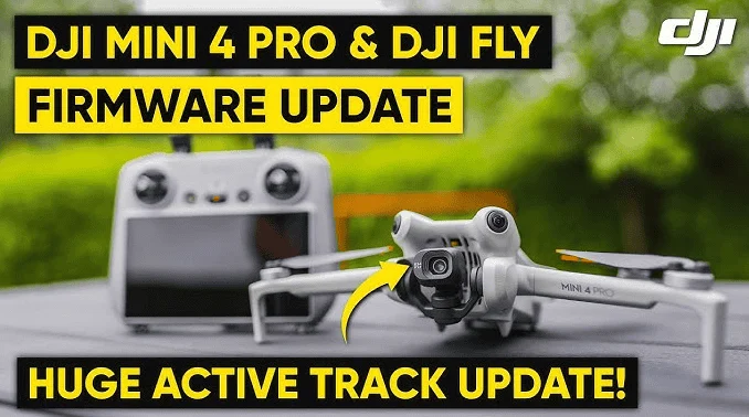
The interface through which a pilot interacts with their drone is the primary control application. For the vast majority of users, this means the DJI ecosystem, including DJI Fly, DJI GO 4, and DJI Pilot. These apps are tailored to specific hardware lines, offering everything from basic camera controls to advanced "Intelligent Flight Modes" like ActiveTrack and Point of Interest.
However, the professional community often seeks more flexibility than proprietary apps provide. This has led to the rise of Litchi, a third-party application that utilizes the DJI Software Development Kit (SDK). Litchi is favored for its robust waypoint mission planning, which allows pilots to program complex flight paths on a desktop computer and sync them to their mobile device. This level of precision is critical for cinematographers who need to repeat the exact same shot across different times of day or seasons.
Similarly, for users of Autel Robotics hardware, the Autel Explorer app provides a comparable suite of professional tools. The competition between these software ecosystems has driven a rapid pace of innovation, with features like obstacle avoidance visualization and advanced thermal imaging integration becoming standard in professional-grade control apps.
Cinematography and Post-Production Enhancements
The utility of drone applications extends beyond the flight itself. For many pilots, the drone is a flying camera, and the goal is high-quality visual content. Sun Surveyor and PhotoPills are two applications that have become indispensable for aerial photographers. These apps allow pilots to predict the exact position of the sun or moon at any given time and location. By understanding the trajectory of light, pilots can plan their flights to coincide with the "Golden Hour," ensuring that their footage features the long shadows and warm tones that define professional cinematography.
Once the footage is captured, the focus shifts to mobile post-production. The rise of social media has created a demand for rapid content delivery. Adobe Premiere Rush and CapCut have filled this gap, allowing pilots to transfer high-definition files from their drone to their phone via Wi-Fi and edit them on-site. These apps offer sophisticated features like color grading, speed ramping, and multi-track editing, enabling a pilot to go from landing to publishing a polished video in a matter of minutes.
Industry Impact and the Future of Digital Flight Support
The integration of these applications has had a profound impact on the safety statistics of the UAV industry. According to industry data, pilots who utilize pre-flight checklists and weather-monitoring apps report a significantly lower rate of "hull loss" incidents. Furthermore, the use of airspace awareness apps has reduced the number of unauthorized incursions into restricted airspace, a trend that is vital for the continued integration of drones into the broader aviation landscape.
Industry experts suggest that the next frontier for drone applications lies in Artificial Intelligence (AI) and the Internet of Things (IoT). We are beginning to see the emergence of apps that can automatically detect hardware anomalies before they cause a crash, or apps that use AI to identify and track specific objects for search and rescue operations.
Summary of Best Practices for Mobile Integration
To maximize the benefits of these digital tools, professional pilots adhere to a strict set of mobile management protocols:
- Device Dedication: Using a dedicated tablet or smartphone for flight operations to prevent interruptions from phone calls or background app updates.
- Offline Data Management: Downloading maps and weather data for offline use, as many flight locations lack reliable cellular service.
- Firmware Synchronization: Ensuring that the mobile application version is always compatible with the drone’s firmware to avoid mid-flight software conflicts.
- Power Redundancy: Maintaining external power banks to ensure the mobile device—often the most power-hungry part of the controller setup—does not fail during a mission.
The role of a drone pilot has evolved into that of a digital systems manager. Success in the field is no longer determined solely by manual dexterity with a controller, but by the ability to interpret and act upon the vast streams of data provided by these essential applications. By leveraging these tools, pilots can ensure that every takeoff is backed by data, every flight is protected by situational awareness, and every landing is the result of a well-executed, professional plan. As the technology continues to mature, those who master this digital ecosystem will remain at the forefront of the aerial revolution.