The rapid proliferation of Unmanned Aerial Vehicles (UAVs), commonly known as drones, has transitioned from a niche hobbyist pursuit to a multi-billion-dollar global industry, necessitating a sophisticated infrastructure of digital tools to ensure safety, compliance, and operational excellence. In the current aviation landscape, operating a drone without a suite of specialized applications is increasingly viewed as a high-risk endeavor, comparable to navigating a vehicle without mirrors or a dashboard. As airspace becomes more crowded and regulations more stringent, the reliance on digital ecosystems for flight planning, weather monitoring, and airspace authorization has become the cornerstone of responsible piloting. This shift marks a move away from the "Wild West" era of drone flight toward a standardized, professionalized environment where data-driven decisions precede every takeoff.
The Regulatory Landscape and Airspace Management
The primary challenge for any drone pilot, whether recreational or commercial, is the navigation of complex and often invisible regulatory boundaries. Controlled airspace, Temporary Flight Restrictions (TFRs), and "No-Fly Zones" (NFZs) pose significant legal and safety risks. To mitigate these, the industry has seen the emergence of sophisticated navigation and airspace awareness applications that provide real-time data on the status of the sky.
A prominent tool in this sector is AirMap, a platform that has become synonymous with digital airspace management. AirMap provides pilots with high-resolution maps that detail restricted areas, including airports, military installations, and national parks. Furthermore, it facilitates the Low Altitude Authorization and Notification Capability (LAANC), allowing pilots to request and receive near-instantaneous flight authorization from the Federal Aviation Administration (FAA) in the United States and similar bodies globally. The integration of such technology is a response to a historical surge in "near-miss" incidents involving manned aircraft, which prompted aviation authorities to demand better visibility for UAV operations.
Complementing this is B4UFLY, the FAA’s official safety application. While initially basic, its recent iterations—often powered by private-sector partnerships—provide a simplified "Clear for Takeoff" status based on the pilot’s GPS location. For the professional sector, DroneDeploy represents the next tier of utility. Beyond simple navigation, it is an enterprise-grade solution for site mapping and 3D modeling. By automating flight paths, it allows for the precise capture of data used in construction progress monitoring, agricultural yield analysis, and land surveying. The adoption of these tools has significantly reduced the frequency of inadvertent airspace violations, which can carry fines exceeding tens of thousands of dollars.
Meteorological Precision: The Science of Flight Feasibility
Unlike commercial airliners that can withstand significant turbulence, drones are highly susceptible to atmospheric conditions. Wind shear, precipitation, and even solar activity can compromise a drone’s stability and its communication link with the pilot. Consequently, meteorological applications have become indispensable components of the pre-flight checklist.
UAV Forecast is widely regarded as the industry standard for drone-specific weather data. Unlike general weather apps, it provides granular data on wind speeds at various altitudes, visibility, and the "K-index," which measures geomagnetic storm activity. High K-index values can interfere with GPS signals, potentially leading to "fly-away" incidents where a drone loses its positional lock and drifts with the wind.
Furthermore, applications like Windy offer a more visual, macro-level perspective of weather patterns. By utilizing various global forecast models (such as ECMWF and GFS), Windy allows pilots to visualize wind gusts and rain fronts moving across a region in real-time. According to data from drone insurance providers, weather-related accidents account for nearly 30% of all reported hardware damage. By utilizing these specialized apps, pilots can move from reactive maneuvers to proactive planning, ensuring that flights are only conducted within the safe operating envelope of the specific aircraft.
Control Ecosystems and the Evolution of Flight Interfaces
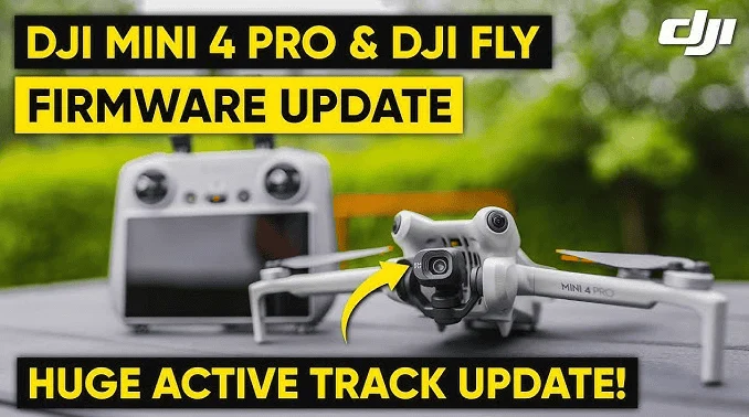
The software used to actually pilot the drone—the Ground Control Station (GCS)—has evolved from simple telemetry displays to complex operating systems. DJI, which holds an estimated 70% of the global consumer drone market share, utilizes the DJI Fly, DJI GO 4, and DJI Pilot apps. These interfaces manage everything from battery health and signal strength to advanced "Intelligent Flight Modes" like ActiveTrack and Waypoints.
However, the industry has seen a growing demand for third-party alternatives that unlock features not available in manufacturer-provided software. Litchi is a notable example, favored by professional cinematographers for its robust waypoint mission planning. Litchi allows pilots to program complex, multi-point flight paths on a desktop computer and then sync them to the drone, ensuring perfectly repeatable shots for time-lapse or high-end production work.
Similarly, for users of Autel Robotics hardware, the Autel Explorer app provides a comparable suite of professional tools. The divergence in software ecosystems reflects a broader trend in the industry: the move toward "software-defined" drones. As hardware becomes more standardized, the "intelligence" of the drone—its ability to avoid obstacles, track subjects, and optimize its own flight path—is increasingly determined by the quality of the application running on the pilot’s tablet or controller.
Post-Production and the Creative Workflow
The utility of a drone does not end when the aircraft lands. For many, the goal of drone flight is the acquisition of high-quality visual data or cinematic footage. This has led to the integration of creative planning and editing tools into the pilot’s mobile workflow.
Applications like Sun Surveyor and PhotoPills are essential for "Golden Hour" photography. They allow pilots to predict the exact position of the sun or moon at any given time and location, enabling them to plan shots where the light hits a landscape or building at the perfect angle. This level of preparation is what separates amateur footage from professional-grade cinematography.
Once the data is captured, the demand for "on-site" editing has grown. Apps like Adobe Premiere Rush and CapCut allow pilots to ingest high-definition footage directly from the drone’s microSD card and create polished edits for social media or client review before they even leave the flight location. This immediacy is a critical requirement in the fast-paced world of digital journalism and real-estate marketing.
Chronology of Technical Integration and Market Impact
The evolution of drone applications has followed a distinct timeline:
- 2010–2014 (The Early Era): Drones were largely manual. Software was rudimentary, focused on basic telemetry. Safety was entirely dependent on pilot skill.
- 2015–2018 (The Expansion Era): The launch of DJI GO and the introduction of geofencing. The FAA introduced Part 107 regulations, and apps like AirMap began to bridge the gap between pilots and regulators.
- 2019–Present (The Professionalization Era): The integration of LAANC for instant authorization, the rise of AI-driven mission planning (DroneDeploy), and the focus on data security and Remote ID compliance.
This technological progression has had a profound economic impact. The global commercial drone market was valued at approximately $28 billion in 2022 and is projected to grow at a compound annual growth rate (CAGR) of 25% through 2030. This growth is directly linked to the reliability provided by the software ecosystem. Industries such as insurance (for damage inspection) and telecommunications (for tower inspections) have only adopted drone technology because the software ensures that flights are repeatable, safe, and data-rich.
Expert Perspectives and Future Implications
Industry analysts suggest that the next frontier for drone applications will be the integration of Artificial Intelligence (AI) and 5G connectivity. "We are moving toward a ‘set-it-and-forget-it’ model for commercial UAVs," says Marcus Thorne, a senior aviation consultant. "The apps of the future won’t just tell you where you can fly; they will autonomously manage the flight, avoid other aircraft via ADS-B In technology, and upload processed data to the cloud in real-time via 5G."
However, this increased connectivity also brings challenges, particularly regarding data privacy and cybersecurity. Recent debates in the United States and Europe regarding the use of foreign-made drone hardware have highlighted the importance of software integrity. As a result, there is a burgeoning market for "secure" apps and "Blue UAS" (government-approved) software stacks that prioritize data encryption and localized storage.
The implementation of Remote ID—a "digital license plate" for drones—is another significant milestone. New applications will be required to broadcast the drone’s identity, location, and altitude to local authorities and other pilots. This will further integrate drones into the broader National Airspace System (NAS), moving them closer to the level of accountability seen in manned aviation.
Conclusion: The Essential Nature of the Digital Co-Pilot
In summary, the modern drone pilot is as much a software operator as they are a flight technician. The "essential apps" for drone pilots are no longer optional accessories; they are the fundamental components of a safe and efficient flight operation. From the regulatory compliance offered by AirMap and B4UFLY to the meteorological certainty of UAV Forecast, and the creative precision of Litchi and PhotoPills, these tools form a digital "co-pilot" that enhances human capability.
As the industry moves toward more complex operations—including Beyond Visual Line of Sight (BVLOS) flights and urban air mobility—the sophistication of these applications will only increase. For the pilot, staying updated with this digital toolkit is not just about getting the best shot or completing a mission; it is about upholding the safety and integrity of the skies for all users. The drone is the wings, but the software is the brain, and in the modern era of aviation, one cannot function effectively without the other.