The rapid proliferation of Unmanned Aerial Vehicles (UAVs) has fundamentally transformed sectors ranging from high-end cinematography to precision agriculture and infrastructure inspection. However, as the hardware becomes more sophisticated, the operational complexity of flying a drone has shifted from basic manual control to a highly regulated, data-driven discipline. For the modern pilot, the drone itself is only half of the equation; the mobile applications used to plan, execute, and process flights are equally critical. Operating a drone without the support of dedicated software is increasingly viewed by industry experts as an unnecessary risk, akin to navigating a complex highway system without mirrors or GPS. These digital tools are no longer optional "extras" but are instead foundational to the pillars of flight safety, regulatory compliance, and professional-grade output.
The Evolution of the Drone Software Ecosystem
The journey of drone technology has seen a dramatic shift over the last decade. In the early 2010s, drone flight was largely a manual endeavor, reserved for hobbyists with significant technical knowledge of radio frequencies and mechanical engineering. As companies like DJI, Autel, and Parrot popularized "Ready-to-Fly" (RTF) platforms, the focus shifted toward the user interface. By 2015, the introduction of GPS-stabilized flight necessitated software that could communicate satellite data to the pilot in real-time. Today, the ecosystem has matured into a sophisticated network of applications that handle everything from airspace authorization (LAANC) to 3D photogrammetry and cinematic lighting predictions.
According to market research data, the global commercial drone market is projected to grow at a compound annual growth rate (CAGR) of over 20% through 2030. This growth is being fueled not just by better drones, but by the "Software as a Service" (SaaS) models that allow pilots to turn raw aerial data into actionable insights. Consequently, the role of the pilot has evolved into that of a data manager, where the ability to navigate various mobile applications is as important as the ability to manipulate flight sticks.
Navigation and Regulatory Compliance: Navigating the Legal Sky
The most significant hurdle for any drone pilot is the legal complexity of the sky. Airspace is a finite and highly regulated resource. In the United States, the Federal Aviation Administration (FAA) oversees these regulations, while in Indonesia, the Directorate General of Civil Aviation (DGCA) manages the "SIDOPI" system. To avoid heavy fines or criminal liability, pilots must utilize applications that provide real-time updates on Temporary Flight Restrictions (TFRs), No-Fly Zones (NFZs), and proximity to manned aircraft.
1. AirMap and the Rise of Airspace Awareness
AirMap has long been a cornerstone for professional pilots. It provides a comprehensive map of controlled and uncontrolled airspace. One of its most vital features is the integration with the Low Altitude Authorization and Notification Capability (LAANC). In regions where this is supported, a pilot can request near-instant authorization to fly in controlled airspace near airports—a process that used to take weeks of manual paperwork.
2. B4UFLY: The Standard for Safety
Originally developed as a standalone app by the FAA and now powered through partnerships with private developers like Aloft, B4UFLY is designed for the recreational and commercial pilot alike. It utilizes a simple "status indicator" (Proceed with Caution, Warning, or Action Required) to inform pilots if their current location is legal for flight. For pilots operating in Indonesia, while B4UFLY is US-centric, it serves as a conceptual model for the situational awareness required in any jurisdiction.
3. DroneDeploy: From Flight to Data
For those in the industrial sector, DroneDeploy represents the bridge between a flying camera and a surveying tool. This application allows for automated flight paths designed to capture overlapping imagery for the creation of high-resolution 2D maps and 3D models. In the construction industry, this has become an essential tool for volume measurements and progress tracking, reducing the need for dangerous manual inspections of high-rise structures or unstable terrain.
Meteorological Precision: Managing Environmental Risks
Weather is the single greatest external variable in drone operations. High-altitude winds can differ significantly from surface-level gusts, and solar activity can interfere with the GPS signals that keep a drone stable. Professional pilots rely on hyper-local weather data to protect their equipment, which often costs thousands of dollars.
4. UAV Forecast: The Pilot’s Essential Briefing
UAV Forecast is widely considered the gold standard for pre-flight weather checks. Unlike standard weather apps, it provides a "Go/No-Go" recommendation based on several parameters:
- Wind Gusts at Specific Altitudes: Drones often face much stronger winds at 100 meters than at ground level.
- K-Index: This measures geomagnetic activity. High K-index levels can lead to "flyaways" due to GPS interference.
- Satellite Lock: The app predicts how many GPS satellites will be visible in a specific area at a specific time.
5. Windy.com: Visualizing Global Patterns
While not drone-specific, Windy.com offers a sophisticated visualization of wind particles, pressure, and rain. For long-range missions or outdoor cinematography, understanding the movement of weather fronts allows pilots to schedule their "golden hour" shoots with surgical precision.
Control Interfaces and Proprietary Ecosystems
The "Control App" is the primary interface between the pilot and the machine. While manufacturers provide their own software, third-party developers have stepped in to fill gaps in functionality, offering more granular control for specialized missions.
6. The DJI Suite (Fly, GO 4, Pilot 2)
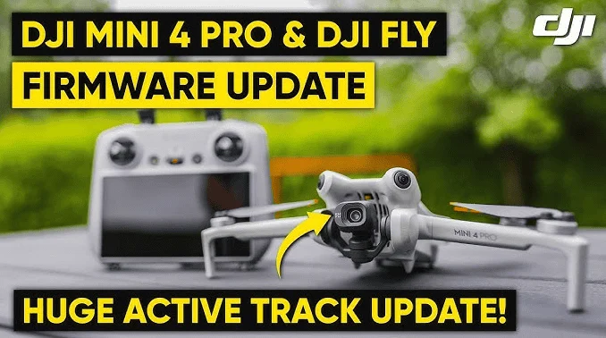
As the market leader, DJI’s software ecosystem is the most widely used. The DJI Fly app is tailored for consumer-grade drones (Mavic and Mini series), focusing on ease of use and quick social media sharing. Conversely, DJI Pilot 2 is designed for the "Enterprise" line, supporting thermal imaging and multispectral sensors used in search and rescue or agricultural monitoring.
7. Litchi: Breaking the Manufacturer’s Limits
Litchi has gained a cult following because it unlocks features that manufacturer apps sometimes restrict. Its most famous feature is "Waypoints," which allows a pilot to program a complex flight path on a computer and then sync it to the drone. This ensures that the drone follows the exact same path every time, which is invaluable for "time-lapse" aerial cinematography or repetitive site monitoring.
8. Autel Explorer
For those utilizing Autel Robotics hardware, the Explorer app provides a robust alternative to the DJI ecosystem. It is praised for its lack of forced "Geofencing," giving pilots more responsibility and freedom to operate in areas where they have legal permission but where software might otherwise prevent takeoff.
Post-Production and Strategic Planning
A successful drone mission ends in the editing suite. The transition from raw footage to a finished product requires tools that can handle the high-bitrate files produced by modern drone sensors.
9. Creative Suite Integration (CapCut and Adobe Premiere Rush)
The demand for "instant" content has led to the rise of mobile editing. CapCut and Premiere Rush allow pilots to download 4K footage directly from the drone to a tablet or phone, apply color LUTs (Look-Up Tables), and export stabilized sequences for immediate distribution. This is particularly useful for real estate marketing and news reporting.
10. Google Earth and Sun Surveyor: The Scout’s Tools
Before the drone even leaves the bag, professional cinematographers use Google Earth to scout topographies. When paired with Sun Surveyor or PhotoPills, a pilot can predict exactly where the sun will be at 5:30 PM in a specific valley. This allows them to align the drone’s camera to capture the perfect lens flare or shadow play, maximizing the "production value" of every battery cycle.
Analysis of Implications: The Future of the "Connected Pilot"
The integration of these applications into daily workflows has profound implications for the aviation industry. We are moving toward an era of "Remote ID," a digital license plate for drones. Soon, apps will not just be for the pilot’s benefit; they will be the primary way drones communicate their identity and intent to other aircraft and law enforcement.
From a safety perspective, the data-rich environment provided by these apps has significantly reduced the rate of drone-related accidents. By providing clear warnings about wind and restricted airspace, software acts as a "digital co-pilot," compensating for human error. However, this also creates a dependency. A pilot who cannot read a weather chart because they rely solely on a "Green Light" from an app may find themselves in trouble if the software glitches. Therefore, the industry consensus is that these applications should augment, not replace, fundamental pilot knowledge.
Conclusion
Becoming an accomplished drone pilot in the current landscape requires a dual mastery of physical flight and digital navigation. The "essential apps" discussed here—spanning navigation, weather, control, and editing—form a comprehensive toolkit that ensures every flight is conducted with the highest degree of professionalism.
By utilizing AirMap for legality, UAV Forecast for safety, Litchi for precision, and Sun Surveyor for artistry, a pilot transforms from a simple operator into an aerial technician. As drone regulations continue to tighten and hardware continues to evolve, these digital tools will remain the most critical asset in a pilot’s flight bag. The message for anyone entering the field is clear: the sky is no longer the limit, but navigating it safely requires the right software in the palm of your hand. Always fly responsibly, respect the privacy of those on the ground, and ensure your digital toolkit is as updated as your flight skills.