The rapid proliferation of Unmanned Aerial Vehicles (UAVs), commonly known as drones, has transformed industries ranging from cinematography and agriculture to infrastructure inspection and emergency response. However, the sophistication of modern drone hardware is only half of the equation; the software ecosystem—specifically the mobile applications used by pilots—serves as the critical interface that ensures flight safety, regulatory compliance, and high-quality data acquisition. Operating a drone without a curated suite of supporting applications is increasingly viewed by aviation experts as a significant risk, akin to navigating a complex waterway without a radar or a map. As global airspace becomes more crowded, the integration of digital tools for pre-flight planning, real-time monitoring, and post-flight processing has moved from being a recommendation to a professional necessity.
The Evolution of the Drone Software Ecosystem
The history of drone flight has transitioned through several distinct eras. In the early 2010s, drone operation was largely a manual endeavor, relying on line-of-sight visual cues and rudimentary radio controllers. As the "prosumer" market exploded with the advent of the DJI Phantom series and similar platforms, the need for integrated software became apparent. Today, the drone industry is projected to reach a global market valuation of over $54 billion by 2030, according to industry analysts. This growth is underpinned by a robust software infrastructure that allows for "smart" flying.
Modern drone applications are categorized into four primary functional areas: airspace awareness and regulation, meteorological analysis, flight control and automation, and creative post-processing. Each of these categories addresses a specific vulnerability in drone operations, from avoiding mid-air collisions with manned aircraft to ensuring that environmental conditions do not lead to catastrophic hardware failure.
Airspace Management and Regulatory Compliance
The most critical challenge facing any drone pilot is the legal and safe navigation of shared airspace. National aviation authorities, such as the Federal Aviation Administration (FAA) in the United States and the Directorate General of Civil Aviation (DGCA) in various international jurisdictions, have established strict "No-Fly Zones" (NFZs) around airports, military installations, and critical infrastructure.
1. AirMap and the Integration of UTM Systems
AirMap has emerged as a leader in Unmanned Traffic Management (UTM). The application provides real-time digital maps of airspace rules and advisories. For professional pilots, AirMap’s most significant feature is its integration with the Low Altitude Authorization and Notification Capability (LAANC). This allows pilots to receive near-instantaneous flight authorization from aviation authorities when operating in controlled airspace. Statistics indicate that the use of LAANC-enabled apps has reduced the waiting time for flight authorizations from weeks to seconds, significantly increasing the efficiency of commercial drone operations.
2. B4UFLY and Situational Awareness
Originally developed by the FAA in partnership with private sector entities, B4UFLY is designed for simplicity. It provides a "status indicator" that informs the pilot whether it is safe or legal to fly in their current location based on GPS data. While primarily focused on North American airspace, its model of clear, color-coded safety indicators has set the standard for similar localized apps worldwide, including Indonesia’s burgeoning regulatory framework.
3. DroneDeploy and Industrial Mapping
For pilots engaged in construction, mining, or agriculture, DroneDeploy represents the pinnacle of autonomous mapping. The software allows pilots to define a flight area on a map, after which the app automatically calculates the flight path, triggers the camera, and ensures sufficient image overlap for 3D modeling. This automation removes human error from the data collection process, which is vital for creating accurate "Digital Twins" of physical sites.
Meteorological Precision and Environmental Factors
Drone safety is inextricably linked to atmospheric conditions. Unlike commercial airliners that fly above the weather, drones operate within the planetary boundary layer, where wind gusts, thermal updrafts, and moisture are most volatile.
4. UAV Forecast: The Pilot’s Essential Weather Station
UAV Forecast is widely considered the gold standard for drone-specific weather reporting. Beyond basic temperature and rain probability, the app provides a "K-Index," which measures geomagnetic interference. High K-Index values indicate solar flare activity that can disrupt GPS signals and compass calibration, leading to "flyaways" or loss of control. Furthermore, the app calculates wind speeds at specific altitudes; a drone may experience a calm 5 mph breeze at ground level while facing a dangerous 30 mph gale at 200 feet.
5. Windy.com: Visualizing Global Airflows
While not exclusively a drone app, Windy.com is favored by long-range and professional pilots for its high-resolution visualization of wind particles and pressure systems. Using data from the ECMWF and GFS models, it allows pilots to predict weather windows with high accuracy. For a drone pilot, knowing the exact timing of a passing front can mean the difference between a successful mission and a lost airframe.
Flight Control, Automation, and Platform-Specific Tools
The primary interface between the pilot and the aircraft is the flight control app. While manufacturers provide proprietary software, third-party alternatives often offer enhanced functionality for specific use cases.
6. The DJI Ecosystem: Fly, GO 4, and Pilot
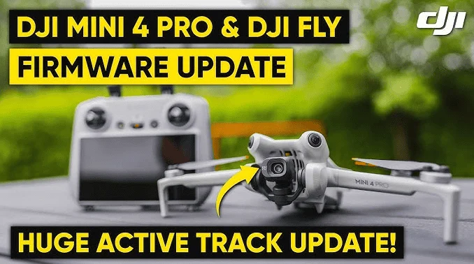
As the market leader, DJI’s suite of apps (DJI Fly for consumer models, DJI GO 4 for older prosumer models, and DJI Pilot for enterprise drones) provides the foundation for most flight operations. These apps handle everything from firmware updates to camera settings and battery health monitoring. They also include "Geofencing" technology, which prevents the drone from taking off in high-risk areas, a controversial but effective safety feature that has prevented thousands of accidental airspace violations.
7. Litchi: Unlocking Advanced Automation
Litchi has gained a cult following among cinematographers for its "Mission Hub." Unlike proprietary apps that may have limitations on waypoint missions, Litchi allows pilots to pre-program complex 3D flight paths on a desktop computer and sync them to their mobile device. This allows for perfectly repeatable shots, which are essential for time-lapse photography or complex cinematic sequences where the pilot needs to focus on the camera gimbal rather than the flight sticks.
8. Autel Explorer
For those utilizing Autel Robotics platforms, the Explorer app provides a robust alternative to the DJI ecosystem. It is noted for its lack of restrictive geofencing, placing the responsibility for legal compliance entirely on the pilot, which is often preferred by professional operators working in specialized environments.
The Creative Workflow and Post-Production
The utility of a drone does not end when the batteries are depleted. The data captured must be scouted, managed, and edited to provide value.
9. Google Earth and Site Scouting
Google Earth is an indispensable tool for the pre-flight phase. By using 3D terrain views, pilots can identify potential obstacles such as power lines, trees, or buildings before arriving on-site. This "virtual scouting" saves time and battery life, allowing the pilot to plan the most efficient flight path for the best lighting and angles.
10. PhotoPills and Sun Surveyor
For high-end aerial photography, timing is everything. PhotoPills and Sun Surveyor allow pilots to predict the exact position of the sun or moon at any given time. This is crucial for capturing the "Golden Hour" or ensuring that the shadow of the drone itself does not interfere with a shot.
11. Mobile Editing: CapCut and Adobe Premiere Rush
In the age of social media and rapid news cycles, the ability to edit 4K drone footage on-site is a competitive advantage. CapCut and Adobe Premiere Rush provide powerful, multi-track editing capabilities on mobile devices, allowing pilots to deliver finished products to clients or news desks minutes after landing.
Safety Protocols and Technical Implications
The integration of these applications into a pilot’s workflow has measurable impacts on safety. Analysis of drone accident reports suggests that over 70% of "pilot error" incidents could have been mitigated by better pre-flight data. For instance, using a weather app to check for wind gusts can prevent motor burnout, while using an airspace app prevents legal entanglements that can result in fines exceeding $20,000 in some jurisdictions.
Furthermore, the industry is moving toward a "connected" model. Future iterations of these apps will likely include AI-driven risk assessment, which will analyze a pilot’s flight plan against real-time data from other aircraft and weather sensors to provide a "safety score" before takeoff.
Broader Impact on the Aviation Industry
The professionalization of drone flight through software is bridging the gap between traditional manned aviation and unmanned systems. Aviation authorities are increasingly viewing drone pilots as "aviators" who must adhere to the same standards of preparation as Cessna or Boeing pilots. The apps mentioned above are the tools that make this transition possible.
By utilizing these digital assets, pilots contribute to a safer "Total Aviation System." The data shared through these apps—such as flight paths and "Notice to Airmen" (NOTAM) compliance—helps prevent mid-air collisions, which is the primary concern for organizations like the International Civil Aviation Organization (ICAO).
Conclusion: The Future of the Digital Pilot
To be a proficient drone pilot in the modern era is to be a master of the digital cockpit. Hardware capabilities have reached a plateau where the differentiator is no longer just the camera’s resolution or the flight time, but the intelligence with which the mission is executed. The "essential apps" for drone pilots are not merely conveniences; they are the structural pillars of a professional operation.
As we look toward a future involving 5G-connected drones and autonomous swarms, the role of software will only expand. Pilots who invest the time to master these applications today are positioning themselves at the forefront of an industry that is redefining the way we view, measure, and interact with our world from above. Flying safely, legally, and creatively is a choice that begins long before the propellers start to spin—it begins on the screen of the pilot’s smartphone.